Categories
Community Events General Live-work-play

pick a park, any park …

pick a park, any park ...

The summer months are often a chaotic time of year when it comes to finding fun, convenient activities that the whole family will enjoy.  This summer, let us help you plan the perfect outing.

Summers in the towns and cities of York Region provide residents with perfect places to spend time outside. Whether it’s picnics, playgrounds, fishing, or just good old fresh air and sunshine, York Region’s parks are an outdoor oasis.

Newmarket’s Fairy Lake

Fairy Lake is a staple location for Newmarket fairs and festivals throughout the summer months. Located just south of Newmarket’s Historic Main Street, this park serves as an urban greenspace in the heart of the town. Featuring playgrounds, gazebos and easy access to the Farmer’s Market at the Newmarket Riverwalk Commons, there is something for everyone. The new Viva service drops you off right at the top of Main Street for easy access.

Vaughan’s Chancellor District Park

Located in Woodbridge, just off of Ansley Grove Road, Chancellor District Park is a go-to greenspace in the community. Outfitted with an outdoor splash pad as well as a playground, this park is an ideal place to take children of all ages to for a day of outdoor fun. On August 3, 2016, this park is hosting a Michael Jackson tribute concert as part of the City of Vaughan’s Concerts in the Park series. If you see our vivaNext booth at a Concert in the Park, be sure to drop by and chat with us!

Markham’s Milne Dam Conservation Park

Located just off of Highway 7 and Markham Road, coming in at 305 acres, Milne Dam Conservation Park is an idyllic place to hike and bike with your family. Featuring 2.3 kilometers of trails running through the forest, a beach area and picnic tables, Milne Dam Conservation Park is the perfect place to immerse yourself in on a sunny day.

Whether it’s the walk in the park after dinner or a concert in the park across town, there are pockets of nature all around the region for everyone to enjoy. So get out your bikes, your picnic blankets and Frisbees because there’s lots of summer left to enjoy and with convenient and fast Viva service ready to take you were you want to go – it couldn’t be easier! Enjoy!

– Sydney Grant, student Public Relations Coordinator

Categories
Community Events Fun & Games

Happy Canada Day!

Today, Canadians across the country are celebrating the 149th anniversary of confederation with a well-deserved sum-sum-summertime day off and long weekend.

At vivaNext, we’re happy and proud to be building rapid transit and creating jobs in wonderfully diverse and fast-growing York Region – the best place to live in Canada!

There’s a great selection of events to enjoy this weekend, including the public debut of the Pride of Canada Carousel. In place of the usual ponies, this incredible carousel includes 44 quintessentially Canadian characters, like a Mountie, a moose, a bumblebee and a beaver, to name a few. Check it out at the Markham Canada Day celebration, noon to 5:00 p.m., Friday July 1 at 162 Enterprise and Birchmount – Viva can drop you right at the door with fast, easy service.

Check out more local York Region Canada Day events in Vaughan, Richmond Hill, Markham, Newmarket and Aurora – and in the nation’s capital.

As you take part in these celebrations, we wish you a fun, safe long weekend enjoying all the things Canada has to offer. Make your commute more enjoyable and take transit as part of your holiday adventures this weekend.


Questions or comments? Comment below or email us at contactus@vivanext.com. To stay up-to-date on construction, sign up for email updates at vivanext.com/subscribe.


Categories
Construction General

what’s in a sign?

What’s in a sign?

Even with the most careful planning, construction zones pretty much always result in some delays and congestion for commuters, and we know that our vivaNext rapidway projects are no exception. We are committed to doing whatever can be done to minimize the impact of construction and keep people informed.

One way of doing that is to let drivers know if there’s congestion along their route, and if so, how much of a delay they can expect. By giving real-time information, drivers can decide if they should take an alternate route.

That’s why we install variable message signs, or VMS, on the approaches to our construction zones, including along Yonge Street and on Highway 7 near the Vaughan Metropolitan Centre.

Using Bluetooth Traffic Monitoring [BTM] software, these signs show actual travel times, in real time, between specific locations. Roadside sensors collect Bluetooth data from passing cars, and the information is uploaded to a central location. The software then analyzes the data to determine current travel times, which is reflected on the signs. In addition to travel time, project managers can update other information on the signs, such as upcoming work or lane closures.

BTM is able to detect Bluetooth signals emitted from cell phones, tablets and other Bluetooth or Wi-Fi devices on-board, and convert this into accurate information, simply and inexpensively. Not all vehicles carry devices with Bluetooth turned on, but there is a high enough proportion of devices to provide effective information.

Cars emitting Bluetooth signals are randomly chosen as they pass into the defined area.  Multiple sensors placed along the route detect the unique identifier of each Bluetooth signal and track it as it travels through the area. In this way, the system measures in real time how quickly cars are moving, and reports actual travel times. The software has built-in algorithms to make sure it only tracks vehicles while ignoring Bluetooth signals emitted from pedestrians or other stray sources. The information is constantly uploaded to the VMS, telling drivers exactly what’s happening on the route ahead.

The technology to use Bluetooth data to analyze travel times has been around for some time.  But vivaNext was actually the first project in North America and possibly the world, to collect and convert this information for display on variable message signs.

What’s in a sign? We know that the signs on their own won’t reduce the disruptions caused by construction. But by providing drivers with accurate travel time information, they’ll know what to expect for their commute.


Categories
Live-work-play Urban Planning

going where the action is

going where the action is

In York Region, there are over 120 bus routes travelled by Viva and YRT buses, and some are busier than others. Some of the busiest routes are on Yonge, Highway 7, Bathurst and Centre Streets, Bayview Avenue and Leslie Street. If you live or work in York Region, there’s a good chance that you travel one of these roads regularly, so it’s no surprise that other people want to go there too.

When building transit, planners have a few goals in mind: ensure most people have access to transportation; have transit where people want to get on and off; and be prepared for future growth and development.

Ensuring most people have access to transportation allows people to get where they want to go, even if they have a specific need or live in a less populated area. In York Region, Dial-a-Ride, community buses and seasonal services [like Canada’s Wonderland!] are examples of this. Community buses take people to places where there’s a special interest, like hospitals, plazas and schools.

The most popular transit routes go where people want to get on and off. People want to go where the action is, so routes are planned where shopping, services, jobs, and higher-density housing is already along the way. One example of this is the area around Bathurst and Centre Streets, where shops and amenities are walking distance to a transit terminal and multi-story condo buildings. Connections to other transit are a big draw too – so routes are planned near bus terminals, GO stations, and future subway stations.

In some cases, we’re preparing for future growth by building transit before development. Enterprise Boulevard in Markham is a planned downtown area near the Unionville GO Train Station that only seven years ago was mostly vacant fields. We opened the first segment of rapidway there in 2011, and since then condo buildings, a sports facility, shops, restaurants and entertainment have all been built, and hotels and a York University campus are on the way.

Whether development is already there or on the way, transit planning means making sure transit is easy to access, and goes where people want to go – an important element in building great communities.


Categories
Construction Rapidways

Yonge at heart

Yonge at heart

At 220 years old, Yonge Street is one of the GTA’s oldest roads, and before it was a road it was likely a trail. Since the beginning, it’s been improved upon and extended. Transit has always been a component of the street, starting with horse-drawn stagecoaches, then streetcars, trains and buses. It’s always been a local road that people walk and bike along, as well as a commuting road for longer distances.

Today, Yonge Street is changing again. We’re building dedicated lanes for transit – rapidways – in Richmond Hill from Highway 7 to 19th/Gamble and in Newmarket from Savage Road/Sawmill Valley Drive to Davis Drive. It’s part of a big plan for a seamless transit system in York Region and the Greater Toronto and Hamilton Area. The Yonge Street rapidway will connect to the Highway 7 rapidways leading to Markham and Vaughan, and to the future Spadina Subway Extension and Yonge Subway Extension.

Once complete, Viva service along Yonge will have faster and more reliable travel times, and traffic congestion will be reduced. Modern transit will be on the doorsteps of people living and working along Yonge Street, and the tree-lined sidewalks and bike lanes will make Yonge an even more attractive, vibrant place to walk, shop and ride.  With people at all stages of life using this important street, transit continues to play a key role.

There is a lot of work happening in 2016, and we’re keeping everyone informed. You can find facts and maps on the project page on our website, and we’ll be at some local community events this summer. We’re also on Twitter and Facebook, and we have some project videos on YouTube. If you would like to contact us directly, our Community Liaisons are available to talk. If you sign up for email updates, we’ll let you know when work is happening and you’ll receive announcements, project newsletters, and an invitation to an open house we’ll be hosting later this year.


Categories
Rapidways Safety Video

navigating the rapidways

click here to see the video -- rapidway intersections: safe journeys

Safety on the rapidway is everyone’s responsibility, and at vivaNext, we take it seriously. But that doesn’t mean we can’t look at an important topic in a light hearted way. You’ll need to watch our latest safety video to fully understand what we mean, but one thing is certain: you’ll be able to relate to one of our four travellers as they navigate our roads with Viva rapidways.

Motorist Molly, for example, needs to get to her mid-block destination, but gets stuck waiting for a left turn signal. What could be causing the problem?

Cyclist Cedric also has a turning concern while on the move. When travelling on dedicated bike lanes, making a left turn can be tricky business. Must he merge into dangerous traffic to get to the left turn traffic lane? Or is there an easier way?

Pedestrian Percy and his grandfather need to be fully aware of their surroundings when crossing the street, whether it’s to the vivastation in the centre lanes, or continuing to the other side.

However you get around, it’s important to understand what everyone else is doing to make sure your journey is a safe one. Watch the video, get to know the new surroundings, and take care when you’re travelling. Davis Drive and Highway 7 now have new ways to navigate, and there’s more to come!


Categories
Urban Planning

building in place >> the best of both worlds

building in place >> the best of both worlds

Earlier this month, the Province of Ontario proposed changes to the four provincial plans that shape how land is used in the Greater Golden Horseshoe: Growth Plan for the Greater Golden Horseshoe, the Greenbelt Plan, the Oak Ridges Moraine Conservation Plan and the Niagara Escarpment Plan. They’re gathering feedback from the public on all their recommended changes to help protect green spaces and farmland.

One of the key changes proposed is an increase in the minimum Intensification Rate from 40% to 60%, to encourage growth in central areas and reduce suburban sprawl. “Intensification” may sound unfriendly but really it’s just re-using space that we already have. We’ve been building on land in York Region for many decades and our population continues to grow, so when a building comes to the end of its life, there’s a good chance the next building on that land will need to serve more people – whether for housing, business or entertainment.

For example, if a one-level plaza has 10 businesses, when it’s time to rebuild it might be replaced with a five-story building with 15 retail and restaurants on the ground level and 15 apartments above. Because there are more business and residential units than there were before, this contributes to an increased Intensification Rate in the area.

By building in place, adding five business units and 15 residential units to this property instead of building 10-20 detached subdivision houses elsewhere, an acre of green space could be saved. If this new development hosts 80 or more residents and jobs per hectare [2.5 acres], then it also helps support frequent transit service [like a Viva rapidway!].

One proposed change from the Province is to require zoning along transit corridors that supports a higher population and walkable communities. This is important to keep the relationship between people and transit on track. Transit systems need lots of people to jump on board, and people living in downtown areas need the option of transit.

By continuing to build in place, our biggest towns and cities will have everything on their doorstep, and green space nearby. Doesn’t that sound like the best of both worlds?


Categories
Rapidways Urban Planning

New book on ‘complete streets’ highlights the Highway 7 East vivaNext project

New book on ‘complete streets’ highlights the Highway 7 East vivaNext project

The Toronto Centre for Active Transportation [TCAT] has recently published a book on street-transformation projects, called: Complete Street Transformations in the Greater Golden Horseshoe. One of the projects they featured is the vivaNext rapidway on Highway 7 East in Markham and Richmond Hill!

The book includes nine different street-transformation projects from southern Ontario that, according to TCAT, “involved redesigning streets to make more space for one or more of pedestrians, cyclists, or transit riders.”

They also present outputs and outcomes of each project. For the Highway 7 East project, they comment on the safety improvement brought by the transformation, the increase in pedestrians and have included a cyclist and pedestrian count in one segment of the street. And, of course, they also note the improvement in transit travel times, with the BRT shortening the average transit rider’s commute by over 30%.

The most recent edition of Novae Res Urbis (GTA), the urban planning magazine, promoted Complete Street Transformations and said this about the vivaNext project:

“By far the most ambitious project highlighted in the book was the $308-million transformation of Highway 7 East in the City of Markham and Town of Richmond Hill. The former provincial highway was transformed into a multi-modal transportation corridor with bicycle lanes and a dedicated transitway. The result was a dramatic increase in the number of pedestrians, cyclists and transit users in the corridor, as well as a 64 per cent reduction in collisions.”

You can download a copy of the book here. The good stuff about the Highway 7 East project starts on Page 11!

Questions or comments? Comment below or email us at contactus@vivanext.com. To stay up-to-date on construction, sign up for email updates at vivanext.com/subscribe.


Categories
Construction Going Green Rapidways

sowing the seeds on Davis Drive

sowing the seeds on Davis Drive

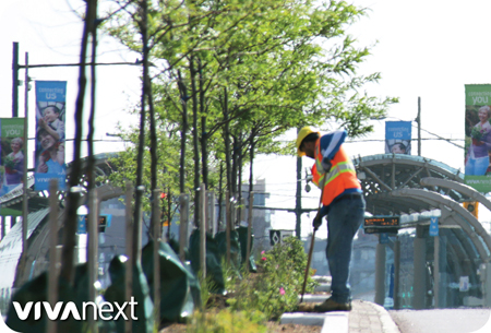
Trees are coming to Davis Drive! Crews are out making their way along the rapidway medians planting trees, shrubs and perennials to create a more attractive, welcoming streetscape. We hope to see buds and shoots blooming all around us in the coming weeks.

To give them the best chance for survival, we carefully choose the species of trees and plants, and plant them in a special planting mix developed by the Region’s Forestry Department, rooted in special soil cells. Even with this great care, nature is unpredictable and sometimes a few don’t make it through the winter. In this case our contractor replaces them under the two-year warranty we have for all of our trees, shrubs and plants. Trees and other green spaces have been shown in studies to have health benefits, build prosperity and increase safety, so they’re an important addition to streets in York Region.

The vivaNext project delivers more than just great transit. With all the plantings on Davis Drive it also reinforces York Region’s Greening Strategy as part of great community design. The strategy promotes actions that support healthy natural environments, and it plants the seeds of inspiration for cultivating sustainable communities.

#ThanksDavisDr!

Keeping with the green theme, May 7 was the Town of Newmarket’s Community Cleanup & Fun Day, and it was a stellar community event! People from all over Newmarket gathered together to pick up garbage and brighten their community by getting involved and getting their hands dirty [gloves were provided!].

We were there to do our part, participating in the morning cleanup and crushing icy snocones for everyone to enjoy. It was our opportunity to say thank you to the people of Newmarket for all their patience, understanding and feedback during construction.

There’s just a little bit left to do before we can call it done, and have a rapid transit system we can all be proud of. Thanks Davis Drive!


Categories
Video

connecting Vaughan – east and west

connecting Vaughan – east and west

We’re building rapid transit in York Region – Bus Rapid Transit and subways – to connect York Region residents and commuters from north and south, east and west. Markham and Newmarket both have east-west rapidway connections, and next it’s Vaughan’s turn. From Yonge Street to Helen Street west of Highway 400, the new vivaNext rapidways will connect travellers with fast, convenient Bus Rapid Transit.

Vaughan Metropolitan Centre [VMC] is a hub of activity and the rapidway project is moving ahead quickly to open between Jane Street and Bowes Road by the end of 2016. Along the rapidway, Viva will stop at vivastations at Creditstone Road and Keele Street. Once the Toronto-York Spadina Subway Extension [TYSSE] opens in December 2017, Viva riders will also be able to connect at a vivastation west of Jane with direct access to the new subway station below, and a YRT bus terminal a short walk away. To see an overview of the project, check out our latest video.

This spring, construction begins on rapidways that will link vibrant communities in the east and west of Vaughan to the transportation options and development in the VMC, and to the rest of York Region.  We know it helps to be aware of what’s happening and when, so we promise to keep you informed and up-to-date along the way. If you haven’t already, be sure to subscribe to email updates for vivaNext projects, and follow us on Twitter.