Categories
General Studies Urban Planning

how transit and city planning work together

how transit and city planning work together

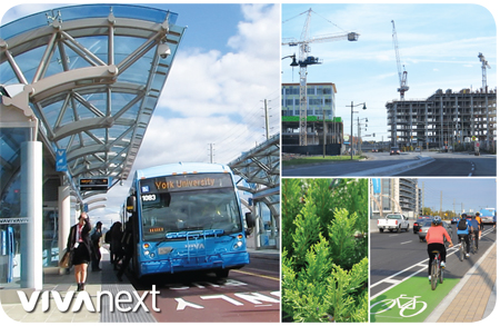
An exciting new urban planning report — Make Way for Mid-Rise: How to build more homes in walkable, transit-connected neighbourhoods proposes actions that would help increase density along transit lines in the Greater Toronto Area. The report was released by the Pembina Institute and the Ontario Home Builders’ Association on Monday, May 4.

The nugget of this report is that the range of affordable housing choices for families would increase by building mid-rise, mixed-use buildings along transit lines. The report argues that mid-rise development supports “healthy lifestyles and local economies, since it can help increase walkability and put more people close to transit, while also supporting local business.”

So, should our communities “make way for mid-rise”? If we want our cities to have a better chance of developing the type of population density that supports a healthy neighbourhood with street life, walkability, and good transit, then, yes!

As the populations of York Region and the Greater Toronto and Hamilton Area increase, it’s the job of government, urban planners, and developers to ensure that the community infrastructure is properly accommodated, and resources like farmland and clean water are protected.

The Make Way for Mid-Rise report presents five ways to support increased density:

  1. Require minimum densities along rapid transit lines
  2. Eliminate minimum parking requirements
  3. Pre-approve mid-rise development along avenues and transit corridors
  4. Require retail planning before mid-rise is built
  5. Make parkland dedication rules more equitable

When transit planning and urban planning work together, the result can be what vivaNext is all about: great cities and great transit, hand in hand.

Take a few moments to check out the report, Make Way for Mid-Rise, and read more about the proposals in the Toronto Star.

 

Categories
Uncategorized

earth hour – make it count

earth hour 2015

It’s that time of year again, when we turn off the lights and other electronics for an hour on Saturday, March 28 at 8:30pm. To raise awareness about climate change, this hour reminds us that with only a small amount of effort we can use less energy. In York Region and Simcoe County last year, Powerstream recorded 48 megawatts in savings – enough to power 1,480 homes for 24 hours.

Aside from Earth Hour, you can be planet-friendly by doing things like using energy-efficient light bulbs, mowing your lawn less, walking or biking and sharing your ride or by taking transit. Viva may be blue, but it is a great green alternative! Every little thing counts, and it all adds up to a healthier environment.

So, York Region… enjoy your candle-lit dinners, your early-spring walks, some quiet time or take a ride on transit. If you’re looking for Earth Hour activities Saturday, check out some of the events happening around the Region, at community centres and local businesses: Powerstream blog about events in Markham and Vaughan, Facebook community page for Earth Hour in Newmarket, Earth Hour 2015 official video.

Categories
Urban Planning

transit benefits times three…

transit benefits times three

It’s true that we’re building a key component of the transit infrastructure connecting the GTA, but beyond this we’re also creating measurable benefits. We support the “triple bottom line” business principle, which holds that business activities should result in financial, social and environmental benefits. Part of our vision is to have development and public transit planned together to shape communities, support a sustainable future and promote energy conservation.

More than 1,100 residential units were added during 2014 along the Highway 7 East rapidway. New zoning and municipal plans are ensuring that development is mixed-use – including places to live, work, shop, and green space to hang out. Mixed-use is a more sustainable, environmentally-responsible way of growing for the future. Once transit is in place and urban neighbourhoods are established, residential and commercial developers are attracted, as are new employers who want to be located near transit and a well-educated workforce.

More compact, transit-oriented and walkable areas mean less dependency on cars, and this is good for the health of transit users, bicyclers and walkers. Socio-economic benefits are there for those who find they can get around more affordably, and our carbon footprint is reduced, since each bus can replace up to 70 cars.

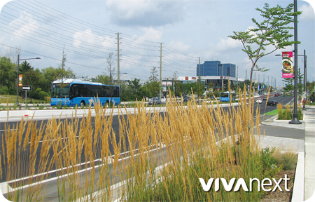
Each new rapidway includes tree-lined streets to help maintain our connection to nature and improve air quality. There is also documented evidence that green space results in higher property values, increased business outcomes and reduced energy costs.

As each rapidway project connects York Region, the benefits are three-fold for the environment, our quality of life, and our local economy.


Categories
Going Green

our buses are blue but we think green

our buses are blue but we think green

In York Region, we’re lucky to have nature around us. From the Oak Ridges Moraine to our woodlands, waterways and wildlife, life is better when we’re surrounded by it.

Rapidway projects are designed with future growth in mind – including supporting population growth and supporting a large variety of new trees and shrubs. Along with dedicated lanes for rapid transit, each project brings urban renewal with wider sidewalks, updated utilities and plenty of trees, shrubs and plants. Since these are construction projects that include widening the road, some of the existing roadside and median trees need to be removed.

We’re currently removing trees located in York Region’s right-of-way for the Yonge Street rapidway project in Richmond Hill and Newmarket. All trees marked for removal were carefully evaluated first, to see if any could be transplanted. Due to the health of the trees and the potential conflicts with overhead and underground utilities, relocation was not possible. Crews will remove the majority of the trees before bird nesting season begins in mid-April. Any trees that still need to be removed after that will first be assessed by a Certified Arborist. Remaining trees around the construction area will be fenced and protected.

Once complete, each rapidway will be a tree-lined street, with attractive landscaping and trees and shrubs chosen for hardiness, appearance and height [to fit under hydro lines once mature]. An urban setting can be tough on a tree, so we use soil cell technology – a rigid framework under the sidewalks in rapidway areas that holds much more planting soil – to protect roots and ensure soil and water stay in place [e.g., see the soil cells we used on Highway 7 East]. New plantings have a guarantee, so if we have especially harsh weather, any that don’t make it will be replaced.

It takes a lot of effort, patience and planning, and the construction itself isn’t pretty. But our communities are growing and the rapidways let us connect faster using transit while keeping our connection to nature and greening our corridors. After this long cold winter, we will all be happy to see a few buds on the trees this spring!


Categories
Rapidways Stations

rapidways in winter

rapidways in winter - Town Centre Station on Highway 7 East

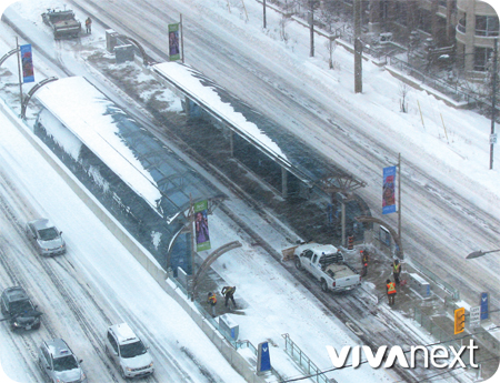
It’s definitely winter! Nobody knows that better than outdoor maintenance crews. When there is snow and ice, York Region’s crews are on duty on our new Highway 7 East rapidway, clearing the way for rapid transit. In Markham, the rapidway travels down South Town Centre Boulevard and Cedarland Drive. The glass canopies at vivastations shelter Viva customers from light flurries, but when heavy snow or ice make an appearance, the heated enclosure is where you want to be.  To remove the snow at the stations, a contractor from YRT/Viva operations shovels and salts the vivastation platforms so that they’re safe for everyone. Sidewalks are usually a municipal responsibility, so the new sidewalks along the Highway 7 West rapidway are cleared by the City of Markham and Town of Richmond Hill.

.
Before the rapidway was built on Highway 7 East, sidewalks were few and far between, and there were smaller curb-side Viva stops. The street has now been transformed from a suburban freeway to a walkable urban street and transit route [with bike lanes!]. With the new facelift complete there are benefits for everyone and the same treatment is coming next year on Davis Drive!  Think spring!

Categories
Announcements General

introducing our new board members

introducing our new board members

For those of you who have been riding along with us on this transit journey, we are excited to update you on our award-winning rapid transit initiatives as we begin 2015 and new stages of construction. This is an exceptionally exciting time for transit in Ontario, and in York Region. Over the next five years, we will be completing $3.2 billion of infrastructure, including rapidways in Newmarket, Vaughan and Richmond Hill, a state-of-the-art Operations, Maintenance and Storage Facility and more. We remain dedicated to building transit options that complement the future of York Region, knowing that everyone shares the benefits of these successes.

How do we do it? Here’s a bit of information about the governance structure and make-up of York Region Rapid Transit Corporation [YRRTC] and how we operate to deliver vivaNext plans. First, YRRTC is a 100% share capital corporation owned by York Region. Our rapidway projects are funded by Metrolinx [an agency of the provincial government], and our facilities and terminals are funded from a combination of federal, provincial and regional government sources. Our governance structure is well established through formal documents and legal agreements between YRRTC, York Region, the provincial government, the federal government and Metrolinx. These legal documents set the framework for how we work together and list the conditions of our funding.

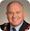
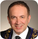
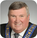
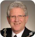
YRRTC reports monthly to a board of directors – seven Mayors and Regional Councillors from Markham, Richmond Hill, Newmarket and Vaughan. Once appointed, they elected a Board Chairman, Vice-Chairman, and CEO. We welcome the new and returning board members:

Chairman - Frank Scarpitti, Mayor of the City of Markham Chairman
Frank Scarpitti
Mayor of the City of Markham
Vice-Chairman - Maurizio Bevilacqua, Mayor of the City of Vaughan Vice-Chairman
Maurizio Bevilacqua
Mayor of the City of Vaughan
Director and YRRTC CEO - Wayne Emmerson, Chairman and CEO of The Regional Municipality of York Director and YRRTC CEO
Wayne Emmerson
Chairman and CEO of The Regional Municipality of York
Director - Dave Barrow, Mayor of the Town of Richmond Hill Director
Dave Barrow
Mayor of the Town of Richmond Hill
Director - Tony Van Bynen, Mayor of the Town of Newmarket Director
Tony Van Bynen
Mayor of the Town of Newmarket
Director - Jim Jones, City of Markham Regional Councillor Director
Jim Jones
Regional Councillor, City of Markham
Director - Vito Spatafora, City of Vaughan Regional Councillor/Deputy Mayor Director
Vito Spatafora
Regional Councillor/Deputy Mayor, Town of Richmond Hill


Through monthly reports and other regular reporting tools such as business plans and annual reports, we seek direction from the board and keep them informed of project progress. These documents can be found in our website Document Library.

It’s complex, with multiple levels of government and representatives from different municipalities, but it’s a clean mission to collectively deliver rapid transit. And together we can continue to deliver these beneficial infrastructure projects to your community and ensure all needs and issues are addressed quickly and openly.


Categories
General Urban Planning

engineering for better traffic operations

engineering for better traffic operations

You may not know this, but the vivaNext segments already open or under construction involve much more than building a cutting-edge Bus Rapid transit [BRT] system. One of the goals is to support the improvement of York Region’s transportation network, so that it works better for all travellers whether they’re going by transit, foot, bike or car. But before improvements can be made, a lot of work needs to be done to identify the constraints and how they can be fixed. This is where the complex specialty known as “traffic engineering” comes in.

You might think all traffic problems stem from too many vehicles using not enough road space. In fact, it’s much more complicated than that. Effective transportation systems [including roads] have a direct impact on our quality of life and depend on a wide range of components to work well together so that people and goods can get around. Traffic can get bogged down when key pieces are outdated or poorly designed, whether they’re related to road layout, placement of intersections, speed, traffic signal timing, turning lanes or many other components.

Traffic engineering involves the analysis, design and planning of many of those technical components. As a discipline, it studies how traffic operates and flows, how roadways are designed and controlled, and how best to plan for future roadway networks and transportation systems to support future land use. This includes coordination of the many traffic lights and the length of time of each light.

The scope of components our vivaNext traffic engineers have analyzed, modelled and designed is very broad, and takes into account York Region’s future growth over the next many years. Well beyond the design of the rapidway, we’ve looked at many issues including the site, and users, of future developments; traffic speed and flow; parking; cycling facilities; impacts from the rapidway on right- and left-turning traffic; impacts on side-streets and neighbourhoods; safety for pedestrians and cyclists; traffic signs; signalized intersection design and equipment – to name a few. And all this analysis and modelling is done in conjunction with other work focused on transit priority measures and intelligent transportation systems.

There is a huge body of science behind the specialized discipline of traffic engineering which enables us to accurately model future impacts of design alternatives, allowing us to determine which approach will help traffic move best. With new technology, traffic controllers at York Region monitor major roads on an on-going basis using traffic cameras. And from time to time, they also go back to data collected from that very low-tech approach, of simply counting cars in order to keep everyone moving along smoothly!

At the end of the day, traffic engineers are key players in developing strategies that will improve the overall transportation network, and ensure that an ever-increasing number of users on foot, on a bus, riding a bike or driving a car – are able to get around as quickly and smoothly as possible.


Categories
Rapidways

2014 – a year of action

2014 - a year of action

As 2014 draws to a close, we’re pleased to say that each of our projects saw great progress this year. The Bus Rapid Transit projects start and end at different times so each has its own construction schedule to match the unique challenges, such as: length of rapidway, complexity of underground work, and landscape and infrastructure features like hills and bridges. As we progress through these challenges we consider them milestones, and after a year of milestones there are plenty of moments to look back on.

On Highway 7 East in Markham, the second stretch of rapidway opened from Highway 404 to South Town Centre Boulevard, and construction will be complete on the last piece to Warden Avenue by the end of 2014, with some finishing touches to add in spring 2015. This final section allows Viva customers to experience the future of rapid transit in York Region, from Bayview Avenue in Richmond Hill to the Downtown Markham development area. Riders are already seeing up to 35% travel time savings on the rapidways.

In Newmarket on Davis Drive, utilities and telecommunications were relocated to prepare for road widening and building the rapidways in the centre of the road. Road widening continued and base-layer paving was also completed in sections along Davis. Significant milestones included: completing the structure of the Keith Bridge and reopening the Tom Taylor Trail, moving the Union Hotel into its final location and installing the steel structures for the first vivastation at Longford/Parkside. The glass canopies will be installed over the winter and the vivastations at Main Street and Southlake Hospital are also underway. It’s been a busy, messy year but crews are working quickly. We’re in the home stretch with the rapidway set to open December 2015.

Along Highway 7 West in Vaughan, the first phase of rapidways is well underway and a there has been a lot of progress in 2014. Between Jane Street and the CN Bridge, work continues on base-layer paving, building retaining walls and expanding the CN Bridge, and we’re almost done relocating some underground infrastructure. East of Jane Street, the road has been widened and traffic has been shifted, so that work in the centre of the road [including paving, installing vivastations platforms and canopies!] can begin in 2015. The contract for phase two of the rapidways in Vaughan will be awarded in 2015, adding dedicated bus lanes and vivastations from Edgeley Boulevard to Pine Valley Drive and from Bowes Road to Yonge Street [in blue on map]. While some pre-construction activities are already underway, construction is expected to begin in late 2015/early 2016.

On Yonge Street in Richmond Hill and Newmarket, the contractor is working to finalize the rapidway design and construction schedule. Meanwhile, crews are out conducting surveys and utility investigations to make sure we have an accurate record of what’s above and below the ground.

We’re also building a state-of-the-art Operations, Maintenance and Storage Facility in Richmond Hill to act as a ‘home base’ for transit. This nine-acre, 481,679 square foot facility will be LEED® certified [Leadership in Energy and Environmental Design], and is scheduled to be complete mid-2015.

Everyone’s busy making memories during the holidays, but we hope that you’ll have a few moments to see some of our videos that give you a sneak peak at rapid transit in York Region:

Where did it all begin? See the launch of curbside Viva service in 2005. Also see the vision for the transformation of York Region and some of the considerations given to the design of the rapidway vivastation, and take a peek inside the rapidway vivastations.

While you’re watching videos, why not find out what’s happening in your community:


Categories
Construction Rapidways

seeing the transformation unfold on highway 7 west

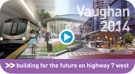
click here to see the video of 2014 Vaughan rapidway construction

we’ve been busy this year

Construction is well underway for the first phase of vivaNext rapidways in the City of Vaughan, and the transformation can be seen along Highway 7 West. Check out our latest video for an up-close look at the milestones we’ve accomplished this year. Although construction will continue throughout the winter months from Edgeley Boulevard to Bowes Road, here’s an update on the progress made in 2014:

  • Traffic has been shifted east of Jane Street to its final configuration, so that work in the centre of the road [including platforms and canopies] can begin in 2015.
  • As part of the 8-metre expansion of the Canadian National Railway [CN] MacMillan Bridge, we poured over 800 tonnes of concrete to create new columns and bridge pier caps.
  • Underground infrastructure revitalization continues – utility, telecommunications and storm sewer relocation is approximately 80% completed.
  • Road widening is completed and base-layer paving is 90% finished between Jane Street and the CN Bridge. Paving activities will continue in 2015.
  • In order to preserve the existing Black Creek and Hillside Culverts, retaining walls were built. In total, five retaining walls have been completed along the corridor with a few more set to get started in 2015.
  • Important traffic and pedestrian changes can be seen at several intersections. Motorists are benefiting from new turning movements and pedestrians now have two-stage crossings.

We know construction can be messy and disruptive at times, and we thank you for your patience and understanding as we continue the transformation. For up-to-date information on construction progress and activities, visit http://www.vivanext.com/hwy7progress.


Categories
Urban Planning

building great cities

Building Great Cities

York Region’s Centres and Corridors strategy is how our Region is making sure there will be room for our growing population to live, work and play, while also protecting our sensitive lands and green zones. As our Region grows, new homes, workplaces, retail and recreational facilities are being established all along the corridors, and clustered in higher density centres in Vaughan, Richmond Hill, Markham and Newmarket.  And to make it easier for people to get where they want to go, without always needing to get in their car, rapid transit corridors featuring Viva’s comfortable Bus Rapid Transit service will link those centres.

Centres and Corridors has been a key component of Regional Council’s strategic priorities, and the amount of development actively underway in all the centres shows that great progress is already being made. But what are the steps required behind the scenes, to create the kinds of communities that are taking shape in the centres?

The first step, and one that was approved long ago, is that Regional Council provided strategic direction confirming the Centres and Corridors plan as the foundation for the Region’s Official Plan.  The Provincial Growth Plan for the Greater Golden Horseshoe reinforces the principles of increased intensification and city-building, and specifically identifies the four centres as “urban growth centres.”

Included in the Provincial Growth Plan are targets for the number of people and jobs to be supported per hectare. The Region’s Official Plan includes these targets, and also establishes policies to encourage transit, pedestrian-friendly street designs, and mixed-use development.

Building on the Region’s policies, each municipality then has to review their own official plan to make sure it conforms and supports the Region’s plan. Municipalities then develop secondary plans, which set out specific land use rules and targets for defined areas including the centres.  Secondary plans shape future development, providing guidance on minimum densities, building heights, streetscaping and other strategies to encourage welcoming, pedestrian-friendly development.

Once the general rules for land use have been developed, municipalities and the Region then actively work to attract new employers and development investments.  Economic Development experts work with their Planning Department colleagues and with potential investors, to create new or expanded work opportunities.  A key driver for many of the new employment opportunities that have already been announced in York Region is the proximity to rapid transit, and the availability of a strong, educated workforce.

And the last component of our multi-pronged approach is to ensure that new housing options are available all along the corridors and in the centres.  We know that people want to live relatively near to where they work, with a short commute being highly valued.  The new housing developments that are springing up near our vivaNext routes are already providing very attractive options for people wanting an urban home, with great access to transit and work.

City-building isn’t a short-term process, but with all these components working together, bit by bit our centres and corridors are being transformed into exciting, urban places, while protecting and respecting existing developments and our natural environment.  For everyone, that means more options, more choices, and linking it all together, more Viva.