Categories
Construction General

clearing the way for construction

If you’ve ever watched a new subdivision get built, you know how fast the work seems to advance.  Crews install utilities, build rough roads, and before you know it there’s an entire subdivision ready for families.  But building a new roadway in a densely built-up area is a completely different challenge: the work seems to go on for a long time, and progress is hard to detect unless you know what you’re looking for.

We’ve been working flat-out on Davis Drive for a year now, with dozens of complex activities underway or completed from Yonge to Leslie.  Even so, most of our effort so far has been about clearing the way, rather than constructing a rapidway and stations.

That’s the predictable reality of modernizing our roads and revitalizing Newmarket’s infrastructure, but it’s worth explaining why we can’t get going on roadway construction until these steps are completed.

A key work priority has been to build retaining walls to enable the road widening along the hilly contours of Davis Drive,  with that work now nearing completion.

And like all major thoroughfares, the foundations of the existing Davis Drive roadway are literally lined along both sides with existing critical infrastructure carrying water, telecommunications, gas, storm sewers and sanitary sewers.  Much of this infrastructure crosses the road at intervals and in many cases the various utilities are stacked up in multiple layers.  In addition, at the sides of the road are hydro poles and lines, transformers for electricity and telecommunications, fire hydrants, and a whole range of privately owned signs for businesses and commercial buildings.

As much as we love getting to the stage of putting down asphalt and constructing the beautiful viva stations, we can’t start this until the right-of-way is completely clear. Once we’ve built the retaining walls, we need to relocate everything else, one element at a time, further back and out of the way of the new wider roadway.  Relocating utilities is a complex task in itself, requiring a highly detailed level of coordination between gas, hydro, telecommunications and other utility companies.

Each type of utility has its own specific requirements about how and where it can be relocated, and which one goes deepest, which has to be installed last, and so on.  Each element requires its own program of design work and approvals.  And lastly, different crews are responsible for specific utility relocations, and there are rules about how closely they can work relative to adjacent work crews.

So the job of getting the roadway clear for construction is a huge, time-consuming and enormously detailed process – without even considering the new bridge and retaining walls that are underway. With multiple activities to be carried out in each block, some people may wonder why we’re not progressing more quickly.  But the reality is that we’ve already completed much of the work needed to clear the roadway, and widening has already started in some segments.  Because so much of the work is underground, there isn’t much to see yet.  But as crews start paving, it will feel and look like progress is starting to take shape.

Even though building a rapidway is a long process, people along Highway 7 in Richmond Hill and Markham can attest that the transformation does come to fruition. Residents and visitors alike are now enjoying the Highway 7 rapidway. We look forward to the day the Davis Drive rapidway is complete and Newmarket can enjoy the finished result too.

Categories
Construction General Live-work-play Rapidways

bringing vaughan metropolitan centre to life

We recently posted a great blog on planning that talked about the link between transit and new urban communities. Given that tomorrow (November 8), urban planners from towns and cities in over 30 countries worldwide will celebrate World Town Planning Day, we thought we would take a moment to highlight another one of York Region’s amazing communities, and see how vivaNext transit projects fit into York Region’s planning vision.

In the Region’s Centres and Corridors strategy, selected areas in Newmarket, Richmond Hill, Markham and Vaughan are targeted to have new, urban “downtowns.” They will be vibrant, higher density, attractive destinations with a full range of amenities so that people can live, work, shop and play in the same community. These “centres” will be connected by transportation “corridors” that will make it easier for people to get around the region. That’s where we come in. Our vivaNext rapidways will run along the corridors, connecting the centres through transit and safe and efficient travel options for pedestrians, motorists and cyclists alike.

You can see the vision for one of these centres coming to life in the City of Vaughan’s new video about the Vaughan Metropolitan Centre [VMC] . Located in the heart of Vaughan, centered on Highway 7, between Highway 400 and Creditstone Road, VMC will be one of the largest and most ambitious development projects in the area’s history, and is a superb location for Vaughan’s new downtown.

In the VMC, mixed-use transit-oriented development is proposed along a tree-lined main street, including businesses, residences, entertainment and cultural facilities, as well as pedestrian shopping areas. The VMC area will act as a transportation hub, including convenient passenger pick-up and drop-off, a York Region Transit bus terminal, and viva rapidways running in dedicated lanes along Highway 7.

VMC will also be home to the northernmost subway station, as part of the Toronto-York Spadina Subway Extension [TYSSE], an 8.6 km subway extension from Downsview Station, northwest through York University and north to the Vaughan Metropolitan Centre. An entrance to VMC Station will be built on Millway Avenue, between Edgeley Boulevard and Jane Street to provide easy and efficient connections to other transit services.

With approximately 442 acres of development opportunities, VMC also includes:

  • Projected office development: 1.5 million SF
  • Projected retail development: 750,000 SF
  • Minimum of 12,000 residential units
  • Population potential: 25,000 new residents
  • Employment potential: 11,000 jobs of which 5,000 will be office jobs

It’s exciting to visualize how Vaughan will evolve in the years to come. To find out more about other vivaNext projects, visit our projects page.


Categories
General

chickens and eggs

Does great planning start with transit?  Or does transit start with great planning?  I was prompted to think about this the other day after reading an interesting newspaper article, Why we’re better off living in hyperdense cities built around mass transit.

The point of the article is that in many ways, we’re better off living in high density cities, as long as they have great transit so that people can live without cars. In particular, this article says the most productive and prosperous cities are those that are planned to have enough density to support a subway system.

Now it’s hard to imagine a time when everyone in York Region would choose to live without a car.  Many of the people in this region have chosen to live here expressly because they love having more room around them, and to have the countryside so nearby.  Cars will always be useful and practical in that kind of setting.

But there are many people – including an increasing number of young people – who like the idea of living and working in a walkable community, where they don’t need to have a car to carry out their daily routines.

The point of good planning is to ensure our communities provide appealing and functional options for both kinds of people.  It ensures that people who want to live in spacious suburban communities have that option without facing gridlock every time they get in their car, while meeting the aspirations of people who want to live in dynamic, urban settings with adjacent, convenient rapid transit.

Planning to make these options possible requires a long-term vision, and a commitment to invest in the infrastructure needed in the future, long before growth happens.  It also requires great transit.  But building a rapid transit system before the density is in place can only be done if there’s a strategic plan that directs densities to transit corridors, so that it all works together.  Rapid transit systems, including BRT like we’re building in York Region, require high volumes of riders to be sustainable.

Which brings me to my original question: what comes first, planning or transit?  The reality in York Region is that they’re intricately linked and interdependent.  Our planners identified many years ago that the future York Region would be bigger and more crowded, and would require more options to house people.  They also identified that those options would only be built and appeal to people if there was great transit nearby.

So the moral of the story is planning and transit need each other, and one can’t happen without the other.  Fortunately, we have both here in York Region – which means we will be able to offer more options for people, no matter what kind of community they want to live in.

Categories
General Live-work-play

a trend away from cars

A recent article in the New York Times described a curious trend that’s showing up in countries as varied as Germany, Norway, Canada and Japan – a trend that shows fewer young people are driving cars compared to their parents.

The findings show that Millennials – people currently in their twenties – are less likely to get their driver’s licence now than in previous generations. Young people are more likely to take transit or cycle, and overall, the number of car trips taken on a per capita basis has been declining for the last several years.  In the US, people in their twenties drive about 20% less than their parents did when they were in their twenties.

There are quite a number of studies that together confirm this trend, although there’s no agreement on what is causing it. Increasing gas prices and weak economic climates in some countries may have contributed to this trend, researchers feel that other longer-term dynamics are the real reason young people are increasingly turning away from the car and finding other ways to get around.

One key theory is that increasing urbanization is a critical factor. In this theory, when people live within walking distance (defined as roughly 500 metres) from transit, it’s easier to leave the keys at home and let transit do the driving.

Whatever the reason, other recent studies carried out show that while baby boomers are ageing beyond the years when they drive the most miles, Millennials aren’t picking up the slack.  The result is that total miles driven is steadily decreasing, and is projected to continue to do so over time.

This change is bound to require a shift in long-term transportation policies developed by governments, including an increased investment in transit.

York Region residents do a lot of driving covering a large geographic area, and even with the launch of vivaNext along its major corridors, there’s no doubt this pattern isn’t going to change overnight.  But as it does, we’re going to be in good shape, thanks to our vivaNext plans for region-wide rapid transit giving residents more options.  We are already seeing the trend here with transit ridership increasing every year.


Categories
Rapidways Stations

making our stations accessible

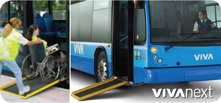
Making public infrastructure, such as transit services, accessible is a priority, and the new vivaNext BRT design more than complies with all the requirements.   Formally, accessibility requirements are legally concerned with people with disabilities, but that’s actually only one component of how we’ve made the stations accessible.

The vivaNext commitment is to ensure everyone feels equally welcome on the station platforms and is able to board the viva vehicles, whether they have mobility or other physical limitations, or are pushing a baby stroller, or for any other reasons they might feel uncomfortable accessing transit service.

In addition to meeting the accessibility requirements set out in Provincial and local regulatory frameworks, we’ve gone to great lengths to design the platforms so all users have a comfortable and pleasant customer experience, and obtained advice and input from the CNIB and York Region’s Accessibility Committee during the design process.

Here’s what we’ve built into the new stations to ensure all users feel safe and comfortable.

  • The ramps to the platform have a shallow incline and handrails on either side, and there are no changes of grade or tripping hazards anywhere on the platform.   For people with impaired vision, the platform edge is clearly indicated through the use of domed tactile tiles in a contrasting colour.  At the primary bus stop location there are directional tiles which provide directional grooves going toward the bus, which will be helpful for people using canes for guidance.
  • People using wheelchairs will have no difficulties getting in and out of the heated enclosures, which provide wheelchair-turning radius inside, and have doors at either end to simplify access.  And the enclosures will have barrier free doors which have been designed to meet the highest accessibility standards including their button placement and operations such as door opening speed and how the door responds if it contacts an object.
  • We’ve included benches inside the enclosure and outside, complete with grab bars for people who appreciate a little help getting up and down.  And for anyone who dreads the chilly experience of sitting on a metal bench in a Canadian winter, we’ve planned for that too – the benches are constructed from durable Brazilian Ipe wood which will make sitting a little warmer in the cold weather.
  • The electronic ITS elements are designed to ensure using the equipment is equally successful for all our customers.   Our fare equipment is designed to be functional for people at wheelchair height or with other physical limitations, with angled screens, clear, bright graphics and large push-buttons.  The VMS will provide clearly visible information on buses, routes and the time.  We extensively researched and analyzed our PA system to make sure it’s clearly audible, and provides full coverage along the platform and in the enclosures. The notice holders for system updates are posted at the right height so they’re easily read whether you’re walking or in a wheelchair.  And we’ve installed large map cases at each platform, illuminated to make it easy for everyone to navigate their route.

Overall, our objective has been to provide a comfortable, safe and welcoming experience for all our transit riders with no barriers or restrictions.

Categories
General Rapidways Urban Planning

welcoming all cyclists

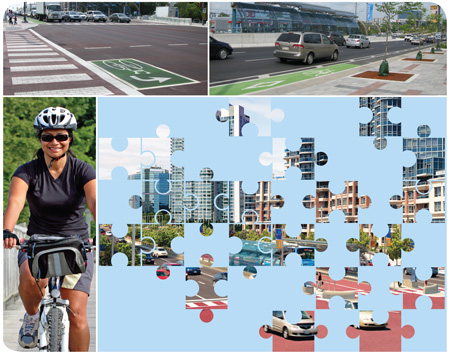
We’ve been focusing recently on all the features of the new rapidways, which together are going to make transit truly rapid along Highway 7.   But it’s important to remember that many of the design features were developed to ensure that all users of the Highway 7 corridor feel welcome and secure.  This includes transit users, pedestrians, cyclists and drivers – the “complete street” design concept which you can read more about here.  One of the features that have been installed on the rapidways are new dedicated bike lanes and bike boxes, which are painted green.

To provide safety and convenience the new bike lanes will extend 5 kilometres, from Chalmers to South Town Centre Boulevard with lanes on both the north and south sides of Highway 7.  Unlike in many urban settings, York Region cyclists will have these lanes to themselves –our new bike lanes are dedicated, meaning they’re not shared at any point with vehicles.

We’re following the established safety standards, making the lanes 1.4 metres wide, with an additional half metre for a buffer zone between the bike and traffic lanes. Also to give maximum visibility for the bike lanes, they’ll be painted a high-contrast green in the areas around intersections, with special bike-lane markings to clearly identify them in the mid-block.

With the high volume of traffic, the bike lanes will provide a much more comfortable and secure environment for cyclists riding along Highway 7.  But eventually most cyclists will want to turn off of Highway 7, with some needing to make left turns.  Waiting in the left turn lane with vehicles to cross multiple lanes of traffic and the rapidways wouldn’t be safe on a bike, so we’re adding another feature to make the experience better for cyclists.  They’re called bike boxes, and they will make the corridor more welcoming to cyclists.

Here’s how they work.  Cyclists wanting to turn left off Highway 7 will proceed through the signalized east/west intersection in the bike lane into the far side  then stop in a protected area, reserved for cyclists, tucked into the boulevard on the far side of the intersection.  This area, known as a bike box, will offer cyclists a waiting zone while they wait for the light to change.  Once the light changes, they will then cross Highway 7 along with other north/south traffic.

The bike boxes will be clearly marked with green paint like the bike lanes and other markings, so drivers and pedestrians will know they are for cyclists only.  Permanent bike boxes will be put in place this fall and replace the painted ones on the street, so by next spring cyclist will have a great new pathway to follow, with the latest of features.

We’re excited to be providing these new features for York Region cyclists, and know that they’re going to help make this corridor much more welcoming to all travellers, no matter how they choose to get around.


Categories
Live-work-play Rapidways Urban Planning

using colour and shape to create welcoming pedestrian spaces

If you’ve walked along the new rapidway on Highway 7, you’ll have seen the vivaNext pavers we’ve installed on the boulevards.  We know from the feedback we’ve gotten that people love the new look.

Most sidewalks in York Region, like pretty much everywhere else, are made of concrete, and the most important consideration is functionality: they need to be safe, accessible, durable and easy to maintain.  But beyond those goals, we also want our new boulevards – which are wider than the Region’s regular sidewalks – to reinforce the complete street concept, the guiding philosophy for our vivaNext streetscape design.  With all the development coming to the Region’s centres and corridors, in the future there will be more pedestrians, whether they live, work, or commute along our rapidway routes.  So we’ve made sure that our boulevard design is going to be visually appealing as well as functional.

The boulevard is made up of the pedestrian zone and the furnishing zone. The pedestrian zone is typically a 2.0m wide sidewalk which is fully paved with light-toned coloured pavers near intersections, and paved with concrete in the mid-block areas. The sidewalk is a continuous system even across driveways to alert motorists that pedestrians have priority.

The furnishing zone is located next to the pedestrian zone. The furnishing zone is an area where pedestrian amenities, furniture and planters are located. It is paved in light coloured unit pavers which reinforce the identity of the vivaNext system.

We’re using a combination of coloured pavers which not only look great but also add to wayfinding for pedestrians.  The main field pavers are light-coloured cool gray with contrasting coloured accent bands which will increase in frequency as pedestrians approach the main intersections. The east-west accent bands are a red; the north-south accent bands are a dark charcoal gray.

Immediately adjacent to the roadway and running along beside the pedestrian zone is a 610mm wide “transition zone”, which will provide an important comfort buffer against bicycle and vehicular traffic. In the winter months, it also provides an area for snow storage and protects the adjacent plantings from salt spray. This zone will be paved in special “eco-pavers”, which allow water to seep through to the storm sewer system.

A charcoal gray coloured textured warning strip will alert visually impaired pedestrians that they are approaching an intersection or driveway. At midblock where the pedestrian zone in paved in concrete, the warning strip will be grooved concrete. Both approaches will provide a tactile clue for visually impaired pedestrians of potential conflicts.

We’ve given special attention to the boulevards near intersections to ensure they reinforce pedestrian priority and add to placemaking. These areas have been designed to function as urban plazas with unit paving and accent pavers. Soft landscaping will define the corners of the intersections and function as gateways to the adjacent areas.

By making the boulevards along the rapidways welcoming and attractive, we’re contributing to the development of York Region’s new urban centres, and adding more walkable places for us all to use.


Categories
General Live-work-play Rapidways

making your trip more comfortable across the YRT\Viva system

You already know how excited we are to be introducing you to our new vivaNext rapidway system, with its comfortable and convenient stations and amenities, now open on Highway 7.   But for many transit riders across York Region, you’re YRT riders as well, and your comfort on that part of your commute is just as important to us.

YRT is currently carrying out upgrades to all their curbside stops across the YRT system to add new amenities and freshen up existing ones.  If you’ve been to the YRT stop at 16th Avenue and Warden you’ll already have seen the prototype that’s going to be installed everywhere.

Each YRT stop will get a modern new shelter, which will provide superior protection from the elements.  And for more comfort, each station will have new benches and garbage containers.  More and more people are choosing to commute by bike but if biking part-way then jumping on YRT\Viva suits you better, YRT is installing bike racks at each stop so you can leave your bike with confidence until your return.

YRT is going to be working their way through the entire system across the Region to upgrade all the YRT stops over the summer, with the Highway 7 rapidway sections being the first to change over to the new amenities this summer.  With the rapidways now open and the new YRT local stops being refreshed, Highway 7 has taken on a refurbished look and feel that highlights York Region’s commitment to serving its residents. Check out this video

These upgrades will bring a new level of comfort to YRT riders, and show the commitment YRT\Viva has to providing all its riders with a great customer experience, no matter what route they’re taking.  We encourage you to come visit the area!

Categories
General Live-work-play Rapidways Urban Planning

need some retail therapy? ….your neighbourhood shops are open

We’ve all heard the term “retail therapy.” For some, shopping can be a remedy to cheer us up and for other’s it’s a way to relieve stress. Perhaps as you read this, you can relate to doing some of your own retail therapy at one time or another.  Whether we’re shopping for a pick-me-up, or need a few items from the store, I’m sure we can all agree there is nothing better than stopping at a good restaurant or finding a little boutique around the corner.

The businesses along the vivaNext rapidway corridors are a great example of the variety of unique restaurants, professional offices, and boutique shops available within your local community. No matter what the stage of transformation– in the heart of construction on Davis Drive, just starting construction on Highway 7 West, getting ready for construction on Yonge Street and completing the transformation of Highway 7 East, there is no change to how any of these businesses serve you.

As you drive or walk along Davis Drive and Highway 7 East you’ll notice the Shop Davis and Shop 7 billboards. These road signs are just one component of a broader advertising campaign in support of your local businesses. During construction along Highway 7 West and Yonge Street you’ll also see Shop billboards along these corridors, to help remind you to support your local retailers.

Perhaps you’ve even seen vivaNext staff out and about in your neighbourhood promoting your local businesses. As part of the shop local campaigns, you may have received a reusable shopping bag to use when you visit stores in your community. If you see a vivaNext staff member, come by, say hello and pick up your reusable shopping bags [while quantities last]. Your local businesses and vivaNext have you covered the next time you are out shopping in the neighbourhood.

To get to your favourite stores on Highway 7, why not take a ride on the new rapidway. The dedicated centre lanes for viva vehicles are now open on Highway 7, from Bayview to Highway 404 and will provide riders with faster, more consistent travel times, getting you to your destination faster so you can shop till you drop!  The new urban landscape and lovely boulevards are a great incentive to visit these revitalized areas in Markham and Richmond Hill. Stop by for some shopping or just stroll around, because these are great places to visit.

Whether you’re shopping for back to school, meeting friends for dinner, or buying a gift for that special someone, your local retailers and restaurants are open for regular business throughout vivaNext construction. To see a sample of the business offerings provided by your local retailers check out the business profiles section of the vivaNext website at vivanext.com


Categories
Rapidways Stations

getting to where you want to go

The installation of the new dedicated rapidway along Highway 7 has resulted in some important changes to the way drivers will get to their destinations, and how the traffic signals work.  Some of these changes have already become familiar to drivers during the construction phase, but it’s worth going over them again now that the Rapidways are open from Bayview Avenue to East Beaver Creek.

  1. Watch for your signal.
  2. There are several different signal phases now operating along Highway 7, and drivers need to be extra alert to pay attention.  The left turn arrow, transit arrow and through traffic signals all work together to keep traffic moving safely.  Pay careful attention to the signal for your lane and the movement you want to make. Watch for pedestrians in the middle if you are making left hand turns or U-turns.

  3. Left turns only during the left turn arrow.
  4. With the rapidway down the middle of the roadway, drivers cannot make left turns mid-block.  Left turns are only allowed from the left turn lane at intersections, on a dedicated left-turn green arrow.  White lines clearly show the left lane turn.  No left turns are allowed on the through green light phase, or the transit green arrow.  Special detectors in the pavement will help the light know how many cars are waiting to turn left, but depending on the length of the queue you may need to wait more than one cycle to make your turn.  If there are no cars detected at a specific time, there will not be a left-turn arrow in that cycle.

  5. U-turns are allowed during the left turn arrow.
  6. If you want to get to a destination on the other side of the road, you can make a u-turn at the intersection when the left turn arrow is lit.  It is important to make sure you turn into the main traffic lanes going in the other direction rather than into the rapidway.  To make it obvious, rapidways are tinted red and have special bus-only markings on them.  U-turns, like left-turns, cannot be made on a through green light, or when the transit arrow is green.

  7. Transit green arrows are for buses only.
  8. The vehicles using the rapidway have their own signal, which is located directly in front of the rapidway.  This signal is only for buses, and depending on the circumstances, it may or may not coincide with the through green light for traffic.   The transit signal has a special hood over it so it can only be seen by transit drivers.  But whether or not a transit vehicle begins to move through an intersection, other drivers must wait for their own green light before proceeding.

  9. Be careful making right turns at red lights, watch for signs.
  10. There are some changes to right turns on Highway 7 from side-streets. At some intersections (East Beaver Creek, Chalmers and Valleymede), right turns on a red lights are no longer allowed. Drivers need to watch carefully for signage indicating that right turns on red, are no longer permitted. These signs are located on the traffic signal pole. Drivers turning right need to be especially alert watching for bikes using the new bike lanes and bike boxes, and when making right turns past YRT buses stopped at curb-side stops.

Highway 7 is a busy street and safety for everyone using it is a top priority.  All these changes work together to get everyone where they want to go safely and in good time.