Categories
Rapidways Subways

in continuous motion

in continuous motion

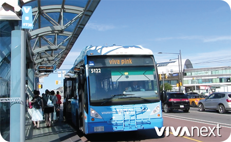
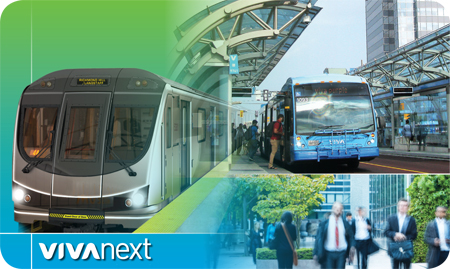
At this point in building York Region’s rapid transit system, we can officially say there are projects at every stage. A few rapidway projects and transit facilities are open for service, some are well underway and some are just getting started.

Having projects at different stages can be beneficial. We learn from every project and fine-tune important processes like procurement, financial management and construction scheduling. Special attention is paid to tailoring detailed designs to ensure quality, and scheduling construction to keep impacts to a minimum. Project management is what we do, and to get everything done, we stack the deck with technical knowledge and lots of experience.

Bus Rapid Transit

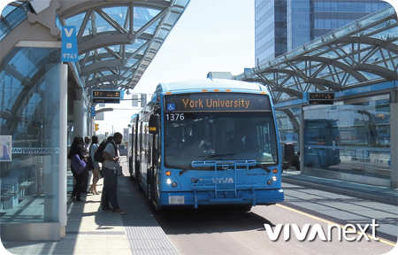
With 34.6 kilometres of dedicated lanes for Bus Rapid Transit [rapidways] completed or underway we have lots on the go, but there is also much more to do. The remaining half of rapidway projects – 34.2 kilometres – have Environmental Assessments completed and are ready to move forward once funding is in place. This includes completing Highway 7 rapidways in eastern Markham and western Vaughan, and Yonge Street rapidways between Richmond Hill and Newmarket, and north of Davis Drive.

Yonge North Subway Extension

York Region’s highest priority, the Yonge North Subway Extension, is ready to move to full engineering and construction. This 7.4-kilometre extension from Finch subway station to Highway 7 in Richmond Hill will include five stations and will complete a missing link in the GTA transit system. The Yonge Subway Extension has been identified by Metrolinx as a priority project, and the Environmental Assessments and some important studies are complete, so once Provincial funding is confirmed for preliminary engineering this project will be moving forward to this important next step.

As with any great transit system, our projects are in continuous motion. Our experience allows us to think ahead, in planning for each project, and in building a connected transit system for those who live, work or commute in York Region. To help plan the transit system in the GTA, Metrolinx is hosting a series of public meetings in York Region and Toronto in the next five weeks. We’ll be there too, so be sure to drop by our booth.

 

Categories
Urban Planning

shifting how we think about transportation

shifting how we think about transportation

One of the great things about huge events like the Pan Am and ParaPan Am Games is seeing how people adjust to the changes the event brings. Leading up to the Toronto 2015 Games, there were some concerns that the Games would cause severe traffic congestion. But thanks to some extra emphasis put on transit and carpooling across the GTA, people have been exploring other choices in how to get around. This, in turn, has likely helped reduce traffic congestion. Whether it’s taking transit, bicycling or carpooling to make use of HOV lanes, every little bit helps.

It’s a shift that takes some getting used to, adjusting to a new routine using a new mode of transit. And it’s this “modal shift” that is so important when developing transit for a growing community.

Most days of the week, many of our roads and intersections are at capacity or beyond. They’re not going to get any less congested as our cities and regions continue to grow, and since there’s limited space in the GTA for roads, there are really only two ways to address congestion.

The first way involves road design, traffic signals and traffic detection systems – known as Intelligent Transportation Systems or ITS, York Region uses this approach to make our existing roads better.

The other approach, which is known to traffic engineers as transportation modal shift but to everyone else as reducing our reliance on cars, is probably the best long-term strategy to reduce traffic congestion. Modal shift means cutting down on the number of trips made by one form of transportation by shifting to other forms of transportation, including transit, cycling or walking.

Modal shift may sound a little technical, or maybe it’s hard to imagine – as if people would get out of their cars all at once and climb onto buses and trains. But really it’s just a matter of small changes in behaviour: taking the bus to the GO station or subway every now and then; carpooling with your co-worker; walking to the convenience store instead of driving; helping the kids bike to school instead of giving them a ride.  All great ideas that the people at Smart Commute and Pembina Institute advocate for.

For successful modal shift, major infrastructure and land use decisions need to be in place, followed-up by investments.  Transit needs to be convenient and reliable; shops and schools need to be within reasonable walking distance; there need to be bike lanes; and jobs need to be located near housing.

Fortunately, all of the long-term decisions and investments that will eventually encourage and enable more people to reduce their reliance on cars are already underway in York Region.  Modal shift away from cars will be able to happen because people will be offered easier, more convenient and reliable ways to get around.

A gradual shift toward other modes of transportation will reduce congestion on our roads. It’s a long-term process, requiring patience, careful planning, and commitment.  It’s also a big part of the vivaNext vision, and with every rapid transit project we build more transportation choices, and the vision becomes an exciting reality.


Categories
Uncategorized

when transit is the star, good things happen

more riders transit legacy

One of the most valuable legacies of the Pan Am and Parapan Am Games is the reliance on transit. In fact, the first vivaNext rapidway on Highway 7 East in Markham and Richmond Hill is actively being used during the Pan Am Games.

And it turns out there’s more to the story.

In an article in this morning’s Globe and Mail, urban transportation reporter Oliver Moore points out that the experience of all these Pan Am transit riders is painting a picture of how great having effective efficient mass transit can be when transit systems are in place, and when transit is actively supported and promoted.

For example:
• The transit agencies across the GTHA are working together more
• People are changing their habits as drivers become riders
• Buses on HOV lanes maintain schedules or are often ahead of schedule

“For riders, it is a glimpse of how fast and reliable surface transportation can be – offering a real alternative – if it does not have to compete with other traffic,” notes Moore.

Now’s that’s a legacy we @vivaNext can get excited about!

Click to read the article.

If you’d like to subscribe to email updates about the progress of the vivaNext project, click on this subscriber link, or go to our homepage at vivaNext.com and scroll down to “subscribe”.

Categories
Fun & Games

moving the masses: Pan Am and Parapan Am Games rely on mass transit to make it all happen

Get ready, the Pan Am and Parapan Am Games are coming to the Greater Toronto Area!

Get ready, the Pan Am and Parapan Am Games have arrived! This is the world’s third-largest international multi-sport games. That means 250,000 visitors, and over 7,000 athletes converging on the GTA this July and August.

When you want to move the masses, you need mass transit.

Imagine 1.4 million spectators [that’s how many tickets there are for the Pan Am Games] potentially trying to make their way to over 300 events all over the GTA from July 10 to 26. Or 50,000 people all going downtown on a single night to attend the Opening Ceremonies at Rogers Centre on July 10.

Without transit, getting people to mega-events like this would be traffic chaos. The Toronto Pan Am/Parapan Am Games is relying on mass transit infrastructure to make it all happen. Organizers have adopted what they call a “transit-first approach” – doing all that they can to get people to take transit during the Games.

  • Tickets to the Pan Am and Parapan Am Games include free transit with local services such as GO Transit, Toronto Transit Commission [TTC], YRT/Viva  and many more.  Just show your Games ticket and ride for free.
  • Extra TTC and GO train service will run during the Games and subway service will start at 6am on Sundays instead of the usual 9am.
  • Several games venues won’t have parking. [Accessible parking is allowed, but should be pre-booked.]
  • Apps and online tools can help people optimize their transit and driving routes.
    • Triplinx is Metrolinx’s interactive transit trip planning tool, which launched in May, and provides step-by-step, real-time directions for transit riders.
    • 2015 Games Trip Planner provides real-time driving and transit routes during the Games.
    • The ‘Call One’ Call Centre, run by York Region Transit, will allow Games spectators to book specialized transit, coordinating service between GO Transit and all nine specialized transit service providers in the Games area, including York Region Transit Mobility Plus.

Our first rapidway on Highway 7 East in Markham and Richmond Hill is ready for the Pan Am Games. While it wasn’t planned specifically for this event, the rapidway will make travelling to events at Markham Pan Am/Parapan Am Centre near Kennedy Road and Enterprise Boulevard much easier.

Major international events like this will often spur the creation of transit infrastructure. The Vancouver 2010 Olympic Games led to the creation of the Canada Line, a light rail train in Vancouver that connected the city to the airport.

Vancouver Olympics organizers encouraged spectators and commuters to turn to transit during the Games, just as Pan Am/Parapan Am Games planners are doing now.

Transit service in Vancouver experienced record ridership during the Olympics, up 31 percent with an average daily ridership near 1.6 million.

There was also an amazing, surprising after-effect. Once people got used to riding transit, they kept riding, even when the Olympics were over.

Ridership increased by nearly eight percent that year, excluding the Olympics numbers, which was partly due to the new Canada Line, and partly due to people keeping up their Olympic transit habit.

Now that’s a legacy for the future.

For mass events, transit just makes sense. When everyone has so many places they need to be all at once, it’s so much easier to be car-free, sit back and enjoy the ride.


Categories
Stations Urban Planning

why stop here?

why stop here?

Some of the most successful investors will tell you that thinking long-term is the best way to make decisions. That’s also the route transit planners take, and a long-term increase in passengers is the goal for the investment.

Rapid transit routes are also planned with potential growth opportunities in mind. By looking at municipal zoning and ‘big picture’ plans, higher levels of government and planners can see where higher-density residential and commercial development will be located in the future. They look at the area around each proposed station to see if it seems likely to redevelop into higher-density residential and commercial destinations. Key pointers tend to be municipal zoning that allows for multi-story buildings, large lot sizes, and older buildings that are more likely to need rebuilding or refurbishing. Stations are especially considered at junctions where current or future transit lines intersect. The area may already have urban amenities and high population, or in some areas, empty land is zoned for a planned high-density community. It’s not necessarily about what’s there now, it’s about what could be there.

By studying the facts, transit planners can be confident about where transit stops should be placed, and know that as the community evolves in future years, new developments will naturally make it more compact, transit-oriented and pedestrian-friendly.

In York Region, the location of rapid transit routes is studied carefully to ensure that as our population continues to grow in the long-term, we’ve invested in a great transit system to support it. The Viva routes were planned with that in mind and now with ridership increasing steadily, rapid transit is moving to one dedicated lane in the centre of the road. With this comes a balanced community that provides vibrant urban centres, faster travel choices, and routes that have more connection points and better serve customers


Categories
General

School’s done – summertime fun begins

School's done - summer time fun begins

Summer is an exciting and fun time for us on the vivaNext project. Warmer temperatures and longer days allow construction of our rapidway projects to get in high gear so they can be completed as quickly as possible. The official start of summer also means the end of the school year.

After the long cold winter that we had, the end of the school year is a chance for kids to get out and play by trading in their school bags and notebooks for swim suits, bikes and camping gear.

Warmer weather and no school mean kids and families are spending more time outside and on our streets. With that in mind, we would like to remind motorists to drive more carefully and with extra caution. It is up to us as drivers to make sure our kids stay safe and remember that kids often run out into the street without looking.

VivaNext wants you and your families to stay safe. We’ve all seen or maybe even done it – whether it’s rushing through a red light or a stop sign to save few extra minutes, forgetting to use traffic signals, overlooking construction detours and speed signs, or not using a hands-free cell phone device. With the heat, hustle and bustle of our busy schedules or fatigue, it’s often easy for drivers to forget or ignore the rules of the road.

During summer when school’s out, it’s even more important to re-think our habits behind the wheel. So, please slow down through construction zones and remember to be a careful driver by looking out for little ones, or better yet, leave the driving to our bus drivers and hop on viva for a more relaxed travel experience.

From our vivaNext family to yours, we wish you a safe and happy summer!


Categories
Uncategorized

moving the masses

moving the masses

Hosting an event on a global scale is no small feat. Preparing to accommodate an influx of tourists and visitors expected in any host city can be a challenge, especially when it comes to how they’ll get around. This is why developments and improvements to public transportation are a major component in staging a world event. From the Olympic Games to the World Cup, public transportation has proven to quickly and efficiently move the masses to and from sports stadiums, and all around the host cities.

Think back to the 2010 Winter Olympic Games held in Vancouver. The city saw the record use of mass transit both during and after the Games, which has changed commuting habits. Mass transit ridership increased by more than 50 percent during the Games and remains well above previous- year levels according to an official Olympic facts and figures report. The city launched a transportation expansion plan which included 48 new SkyTrain cars, a new SeaBus, and 180 diesel-electric hybrid buses, which have lower fuel consumption and fewer emissions, to accommodate visitors.

The UK also saw the success of its $673 million dollar public transportation improvements during the 2012 Olympics in London, where nearly one million people used the system. 900,000 people, almost half of the overall 2 million people who visited Olympic Park, used public transit including shuttles, bikes routes and special light rail. London is already known for its advanced underground Tube system, yet the improvements were part of an over-arching initiative to make the games “greener” and were also implemented as a long-term infrastructural investment.

It comes as no surprise then, that Brazil invested $700 million dollars into bus infrastructure development to be ready ahead of the June 12th start of this year’s FIFA World Cup hosted in Rio de Janeiro. The Transcarioca, a 39 km BRT line with dedicated lanes for buses, officially opened on June 1st and is expected to carry 320,000 passengers daily during the tournament.

Next year, it’s Toronto’s turn in the spotlight as host of the 2015 Pan American and Parapan American Games. There are already plans for transit development and improvement in place to combat traffic congestion and poor air quality. York Region and The City of Markham are pleased to be hosting a sporting event during these games, right on the viva system.

Providing quick and efficient transportation during any large world event ensures that the focus remains on the thousands of people who come together to compete, volunteer, or cheer on – people like you and I. Great transit is just the link that connects us all.

Categories
Announcements General

‘Holey’ ‘Moley’ tunnelling is complete!

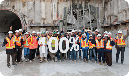
photograph provided by The Toronto Transit Commission [TTC]

Here at vivaNext, we’re excited to announce that the Toronto-York Spadina Subway Extension (TYSSE) project has achieved another significant milestone – tunnelling for the project is 100% complete!

In the summer of 2011, the first Tunnel boring machine (TBM) “Holey” began boring from a launch shaft at the Downsview Park Station site. Since then, rain or shine, TBMs “Holey”, “Moley”, “Yorkie” and “Torkie” have been working hard and have collectively bored 6.4 kilometres of twin tunnels for the TYSSE project.

The final segment of tunnelling was finished when “Torkie” broke through the headwall at the Vaughan Metropolitan Centre (VMC) Station site, finishing the tenth and final tunnel drive for the project. This sets the stage for the next phase of work in the tunnels including installation of inverts and walkways, track, traction power, signals and communications systems.

With help from our friends at Toronto Transit Commission (TTC) we have some pretty cool photos and videos of the breakthrough to share with you on our website – see them here!

The TYSSE is an 8.6-kilometre extension of the TTC’s Yonge-University-Spadina subway line from Downsview Station to the VMC Station at Highway 7 in York Region.

Vaughan’s VMC station will be the northernmost station, connecting to a variety of other transit services. Situated in the future VMC development area, this station will act as a transportation hub, including convenient passenger pick-up and drop-off, a York Region Transit bus terminal, and connection to the viva rapidway running in dedicated lanes east and west along Highway 7.

Residents and visitors alike will enjoy the variety of transit options and mixed-use development offered in the VMC area. It will be a great place to work, shop or relax, and getting there will be easy whether you walk or ride transit.

Construction work for the TYSSE project is expected to be completed by fall 2016. Once the subway extension is completed, it will have 6 new subway stations (check out the TYSSE guide to station names) and 3 new commuter parking lots.

To learn more about the TYSSE project and sign up for construction notices, visit vivanext.com.

Categories
General Uncategorized

wouldn’t you like an extra 32 minutes a day?

Did you know that a recent American study showed that people, who live in areas with good access to transit, are more satisfied with their quality of life than people who don’t have easy access to transit?* This is one of the reasons cited by an intriguing new public awareness campaign, arguing that more and better access to transit is good for communities, families and individuals.

The new campaign – dubbed Your32 – is an initiative spearheaded by the Greater Toronto CivicAction Alliance, a not-for-profit advocacy organization that promotes the economic, social, and environmental benefits of building transit infrastructure across the Greater Toronto and Hamilton Area.  The campaign is being done in partnership with a wide range of leaders representing key sectors across our communities and economy, including business, academia, labour and financial.

The big-picture benefits of transit are well known: it’s better for the environment; it will reduce the gridlock that’s choking our roads; and it will help our economy and productivity.  All of which are reason enough that we need more transit in the GTHA, and we need it now.

But ultimately we all live our lives at a personal level, and this is what the Your32 Campaign does that’s so interesting: it brings the benefits closer to home for each of us.  Your32 refers to the estimated 32 minutes per day that people would save on their commute once the Metrolinx transit plan for the GTHA (The Big Move) is fully funded and built.  32 minutes is the difference between the projected future average commute time if no comprehensive transit system is built, and the average future commute time with the big move.

32 minutes a day: that’s a lot of time over the course of a year – 8 full days – that you could be doing something better with.  And over the course of your life it adds up to about two years of found time.   There are a lot of ways most of us could imagine spending 2 extra years, beyond spending it sitting in gridlock.

The Your32 website has a lot of really interesting facts and figures about commuting and how better transit will benefit all of us, and its aim is to encourage people to become more knowledgeable about the issues and possible solutions.  The campaign is asking people to “pledge” their support for new funding sources that are “dedicated, efficient, transparent & accountable, regional, fair, and sustainable”.  And ultimately, its objective is to continue to build support from people and governments at all levels for more funding for transit in the GTHA.

We’re proud that vivaNext and York Region are already helping lead the move for more transit, and we’re pleased that such a useful campaign is underway to help reach more people and get out the true facts about transit.  I recommend this initiative to anyone interested in learning more, and to add their voice calling for senior levels of government to fund the transit we all need.


Categories
General LRT Rapidways

choosing the right form of transit

In September the Province set up an expert panel to look at how Metrolinx should be expanding transit in the GTHA, and to propose realistic options to pay for it.  The panel has just released their second discussion paper, and it’s well worth a read for anyone interested in getting beyond the rhetoric and really understanding the facts and issues.

Certainly the issue of what transit technology should be funded, and where it should run, is a subject that’s dominated the headlines for months and is of interest to everyone.  It’s understandable that so many have views on this subject, and it’s also reasonable to expect that the people doing the planning should listen to those views.

But in the final analysis, choosing a mode of transit – the main rapid transit options are subway, LRT, BRT and commuter train – shouldn’t be treated like a popularity contest. There’s just too much money involved.  Each mode of transit has its uses, benefits and drawbacks.  Those qualities are well known to transit planners, and need to be thoroughly and objectively analyzed in the context of local circumstances including passenger volumes, current and anticipated densities, employment projections, and present and future land use patterns.

Planners ideally will look at a range of transit modes to meet the needs of users across a region or area, with the primary consideration being a seamless system that enables passengers to make easy, fast connections.  That doesn’t necessarily mean the trip will be non-stop, or use the same technology the entire way.

This is a concept we all already live with, so we shouldn’t expect transit to be any different. Pretend you are taking a trip to a small island in the Caribbean.  You’d probably drive to the airport, then you’d get on a big jet, then most likely transfer to a smaller plane for the last leg, or maybe even a boat if you were going somewhere out of the way. You’d never expect the big jet to swing by your house to pick you up at your door, then whisk you non-stop to the tiny island.  Getting around the GTHA, depending on where you’re travelling from and to, follows the same logic.  Some riders may need to take surface transit, then transfer to one form of rapid transit – and then possibly to another mode to complete their trip.  The key point is to create a system that gets you there as fast as possible.

In a world where there’s only so much new money available for transit, careful decisions are needed to ensure final choices get the greatest number of people into transit, reducing gridlock on the road system.  The most costly option – subways – should be reserved for where it will do the most good, i.e. get the greatest number of cars off the roads.  Given that the need for new transit massively outstrips the money available, every single transit dollar needs to be spent wisely.

Professional analysis of facts has always been the basis for our vivaNext decisions. That’s why we’re installing BRT – the lowest cost form of rapid transit – along Highway 7, with the option to change to LRT when future volumes justify it.  On the other hand, the ridership and future employment projections do justify the cost of extending the subways north to the VMC, and along Yonge Street from Finch to Highway 7, so our plan includes subways too.

We’re proud of the system we’ve planned and are building for York Region, and are looking forward to the day when it will be connected to a system that covers the entire GTHA.  Now that’s something we think everyone will support.