Categories
General

chickens and eggs

Does great planning start with transit?  Or does transit start with great planning?  I was prompted to think about this the other day after reading an interesting newspaper article, Why we’re better off living in hyperdense cities built around mass transit.

The point of the article is that in many ways, we’re better off living in high density cities, as long as they have great transit so that people can live without cars. In particular, this article says the most productive and prosperous cities are those that are planned to have enough density to support a subway system.

Now it’s hard to imagine a time when everyone in York Region would choose to live without a car.  Many of the people in this region have chosen to live here expressly because they love having more room around them, and to have the countryside so nearby.  Cars will always be useful and practical in that kind of setting.

But there are many people – including an increasing number of young people – who like the idea of living and working in a walkable community, where they don’t need to have a car to carry out their daily routines.

The point of good planning is to ensure our communities provide appealing and functional options for both kinds of people.  It ensures that people who want to live in spacious suburban communities have that option without facing gridlock every time they get in their car, while meeting the aspirations of people who want to live in dynamic, urban settings with adjacent, convenient rapid transit.

Planning to make these options possible requires a long-term vision, and a commitment to invest in the infrastructure needed in the future, long before growth happens.  It also requires great transit.  But building a rapid transit system before the density is in place can only be done if there’s a strategic plan that directs densities to transit corridors, so that it all works together.  Rapid transit systems, including BRT like we’re building in York Region, require high volumes of riders to be sustainable.

Which brings me to my original question: what comes first, planning or transit?  The reality in York Region is that they’re intricately linked and interdependent.  Our planners identified many years ago that the future York Region would be bigger and more crowded, and would require more options to house people.  They also identified that those options would only be built and appeal to people if there was great transit nearby.

So the moral of the story is planning and transit need each other, and one can’t happen without the other.  Fortunately, we have both here in York Region – which means we will be able to offer more options for people, no matter what kind of community they want to live in.

Categories
General Rapidways

hard truths about transit

Transit is a top story in the news these days, in Toronto, across the GTHA, in fact all across the country.  And with good reason: the links between the availability of well-planned transit and our ability to sustain our quality of life are well documented.   But the discussion about transit is still confusing for many people, with so many different positions being put forward on how transit should be planned, the merits of different forms of transit, and how to pay for it all.   Meanwhile, gridlock across the GTHA is getting worse.  To ensure we don’t fall farther behind, important decisions have to be made soon about the future transit network in the GTHA.

Fortunately, a significant amount of new transit is already being built across the GTHA including our vivaNext BRT routes and the extension of the Spadina subway up to Highway 7.  But there are a large number of important transit projects, including parts of the vivaNext system such as the extension of the Yonge Subway, which remain unfunded.  Building a connected network across the GTHA, and completing the vivaNext parts of the system in York Region, needs to be a top priority for us all.

To help bring some clarity to the discussion, a newly-established advisory panel in Ontario has been set up to look at the future of transit in the GTHA.  The panel’s mandate is to help Ontario make the right decisions about what transit projects get funded in the GTHA, and how to pay for them.

Getting input from the community is a priority for the panel, and they will be providing a series of discussion papers to help people become better informed.  These papers will be well worth reading for anyone who has an interest in the future of transit across the GTHA.

Here’s a link to the new advisory panel’s site, www.transitpanel.ca which includes the first of several discussion papers.  Over the next few weeks, the panel is also going to be collecting input from the public, business and key stakeholders.  There are a number of ways that you can provide input to the panel.  You can mail, email, and provide input online or by attending one of the public meetings.  Four meetings will be held across the GTHA, including one in Vaughan.

The more people who participate in this discussion, the better: it affects us all, whether we live in suburban areas or downtown, and whether we’re transit users or drivers.  The decisions that need to be made soon about what transit will be built, and how it will be paid for, will shape the quality of life across the GTHA for generations.

VivaNext is proud of what we’re building in York Region, but ultimately the strength of our system depends on being part of a great regional network.  So please check out the panel’s website, read their papers, and have your say.


Categories
Construction General Urban Planning

what is a culvert anyway?


I’m guessing that you probably weren’t thinking about culverts as you sipped your coffee on your commute through the construction this morning — probably not even if you passed right by one. But let me just take a moment to tell you why culverts are important – besides the obvious.

First of all, what is a culvert anyway? Well, I’m sure you’ve seen one by the side of the road, underneath a driveway, around creeks and rivers. A culvert is a tunnel or pipe of varying size, shape and material used to allow water  to move easily from one side of an obstruction (like a road or railway) to the other side.

A culvert has three main functions: to allow for stream crossing; to manage and direct water runoff; and to allow natural wildlife crossing. The first two are pretty self-explanatory, but where it gets interesting is the wildlife crossing.

Since culverts affect both animals and the environment, the Ministries of the Environment, Natural Resources and Transportation have set out specific standards for culverts. Those standards note that they must be constructed in such a way to allow any wildlife travelling through them to see light at the other side. And culverts must include material that mimic the natural landscape of the wildlife passing through it to encourage them to use the culvert for migration.

The typical lifespan of a culvert is somewhere between 10-20 years, depending on a number of factors. When water flows through a culvert frequently, as it does at eastern and western creeks in Newmarket, the culvert will naturally succumb to some erosion. With our plans to widen Davis Drive for the rapidway, we are extending the western creek culvert and removing and replacing the eastern creek culvert that was well beyond its lifespan.

It’s just one more component of an overall transformation towards vibrant urban centres, connected by a rapid transit network to help people get around.


Categories
General Live-work-play

a trend away from cars

A recent article in the New York Times described a curious trend that’s showing up in countries as varied as Germany, Norway, Canada and Japan – a trend that shows fewer young people are driving cars compared to their parents.

The findings show that Millennials – people currently in their twenties – are less likely to get their driver’s licence now than in previous generations. Young people are more likely to take transit or cycle, and overall, the number of car trips taken on a per capita basis has been declining for the last several years.  In the US, people in their twenties drive about 20% less than their parents did when they were in their twenties.

There are quite a number of studies that together confirm this trend, although there’s no agreement on what is causing it. Increasing gas prices and weak economic climates in some countries may have contributed to this trend, researchers feel that other longer-term dynamics are the real reason young people are increasingly turning away from the car and finding other ways to get around.

One key theory is that increasing urbanization is a critical factor. In this theory, when people live within walking distance (defined as roughly 500 metres) from transit, it’s easier to leave the keys at home and let transit do the driving.

Whatever the reason, other recent studies carried out show that while baby boomers are ageing beyond the years when they drive the most miles, Millennials aren’t picking up the slack.  The result is that total miles driven is steadily decreasing, and is projected to continue to do so over time.

This change is bound to require a shift in long-term transportation policies developed by governments, including an increased investment in transit.

York Region residents do a lot of driving covering a large geographic area, and even with the launch of vivaNext along its major corridors, there’s no doubt this pattern isn’t going to change overnight.  But as it does, we’re going to be in good shape, thanks to our vivaNext plans for region-wide rapid transit giving residents more options.  We are already seeing the trend here with transit ridership increasing every year.


Categories
Construction Live-work-play Rapidways

vivaNext – more to come

When it comes to the future of transit in York Region, you don’t have to look far. The first rapidway along Highway 7 east corridor is now up and running smoothly. With it came wide pedestrian-friendly boulevards, lined with trees and other greenery. The transformation taking place along the Viva routes will change how pedestrians, cyclists and motorists not only view the area in general, but get from A to B more easily, more safely and more efficiently.  Check out this 3600 virtual tour for a peak.

This is just the beginning of many miles of rapidway that are under construction or coming soon.  Here is an update of what’s happening.

Construction on Highway 7 East continues and crews are working hard from Highway 404 to Warden Avenue to widen the road, build pedestrian boulevards, plant trees and shrubs as well as installing utilities. This next segment of rapidway is expected to be completed in 2014.

Moving along Highway 7 west to Vaughan, you will see the vivaNext rapidway construction starting to take shape between Edgeley Boulevard and Bowes Road.  Over the last few months, crews have been working to remove signs, test soil and begin utility relocation to prepare for heavier construction.  Throughout the fall and winter, hydro, gas and telecommunications installations and relocations will continue in Vaughan.

Preliminary construction activity will also continue in other parts of Vaughan as vivaNext rapidway construction continues along Highway 7 West.   The Vaughan Metropolitan Centre [VMC] station will be completed in time with the Toronto-York Spadina Subway Extension [TYSSE].  Vaughan’s VMC station will be the northernmost subway station, connecting to Viva and a variety of other transit services, for a convenient and seamless experience.

In Newmarket, as you drive or walk along Davis Drive, you’ll see that construction is in full swing and the transformation is starting to take shape. The relocation and replacement of underground infrastructure in some segments on the south side of Davis Drive is complete. In those sections, road widening and preliminary paving has started preparing the roadway for future rapidways.

Also in Newmarket, crews are working to re-locate the Historic Union Hotel and its adjoining building to their final foundations this fall. Extensive culvert work at eastern and western creek is underway.  Work continues on the north side of the Keith Bridge.  Once completed all this work will help make your travel along Davis Drive smoother and more efficient, especially if you are on transit!

Over the next few years, future rapidways will be added to the Viva routes to better service customers and make travel times shorter by up to 25%.  We know construction is messy, but the end results are marvelous!

Categories
General Urban Planning

introducing the Bayview Towers

The Bayview Towers opened on September 1 for service, just in time for back to school. If you’re in the area near Highway 7 between Bayview and Chalmers/South Park you’ll have noticed two attractive buildings, sporting vivaNext symbols, built right next to the Bayview Bridge.   Here’s a description of the Bayview Towers, and how they’re going to make life more convenient and comfortable for York Region transit users.

The two handsome glass and concrete buildings, one on each of the north and south sides of Highway 7, are there to provide convenient access for people on Bayview Avenue wanting to connect to the viva system, and vice versa.  These buildings replace the stairs that used to be the only way people could make that connection.

Providing elevator access was always seen to be the ideal solution to ensure everyone would be able to move easily from Bayview down to Highway 7, but because elevators need to be located in spaces with constant temperatures and protected from the elements, we needed to create actual buildings around them.

That’s why we have built the Bayview Towers.  The buildings are not bus stations – there are curb-side vivastations on both the north and south sides of Highway 7.  The buildings are both fully accessible, and each has an elevator that will whisk people up to the level of the Bayview Bridge, as well as an interior stairwell.

Inside, the Towers are airy and well-lit, with glass walls making the interiors clearly visible to Highway 7.  With full security coverage including cameras that can monitor the entire building and emergency call buttons on all levels that connect directly to YRT dispatch, people will feel safe using the towers at all times.

At the top level, people will access the Towers via pedestrian bridges that enter onto the sidewalks on the Bayview.  Changes to YRT and Viva routes will go into effect now that the Towers are open, so check out the schedules before you head out.

All in all, we’re proud of these great new additions to our rapidway system, which are going to improve connectivity for everyone using Viva and YRT.


Categories
General Rapidways Stations

introducing our new and improved fare equipment rolling out along Highway 7

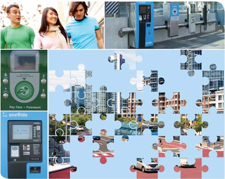
When viva launched its Quickstart service in 2005, our new automated fare equipment used the latest technology. Customers loved the convenience of being able to purchase fares curbside, and drivers loved the way off-board ticket purchases speeded up service.  Well we all know how technology is constantly being improved, and transit fare equipment is no exception.  So as we designed the new rapidway stations, we worked with York Region and YRT to find ways to make our fare equipment even more efficient and user-friendly.

The first seven [7] new rapidway stations are now open on Highway 7 and here’s a virtual tour of the new and improved equipment that you’ll see and how it’s been updated.

The biggest changes are to the completely redesigned Ticket Vending Machine [TVM for short].

The existing equipment uses a touchscreen that works well but can be a bit hard to see when the sunlight is very bright, especially for people with impaired vision.  The new TVM is more like a bank machine, with push buttons rather than a touch screen.

The new machines use a state-of-the-art operating system that makes them faster, with a better printer, and a chip reader to process credit cards and debit cards.  Because our entire system is now connected to the internet through a new fibre optics communications network, credit card and bank transactions will be in real time for improved security. The new TVMs will also take coins for users who prefer to use cash (no change is provided though, so correct change is best).  We’ve also improved the Ticket Validator (TV) for customers who use YRT tickets and passes.

And each station will have two Presto machines to help things move faster.  Just tap and go.

We’re excited about these improvements to the fare equipment, which is all located together at the top of the ramp on the new platforms you can find on Highway 7.  Remember to make sure you have a valid fare before you enter the Fare Paid Zone – and visit YRT\viva and presto for more information.


Categories
Rapidways Stations

this is just the beginning

Over the next three years, the vivaNext system is really going to be taking shape, with rapidways on Highway 7 and Davis Drive opening for service, and the Toronto York Spadina Subway Extension [TYSSE] welcoming its first passengers.  But these new transit options are only the beginning of expanding vivaNext network that’s being built for York Region commuters over the next few years.

Funding for the next priority series of rapidways is already lined up, and we hope to be confirming funding soon for a number of other high priority projects.  Here’s the rundown on what’s planned, and how your transit choices are going to be widened over the next few years as vivaNext continues to expand.

Rapidway projects are being built in the order that will create the most connectivity for the greatest number of people and get you past the worst traffic congestion.  Check out the map to see how the phases are rolling out.

The segments that are coloured pink on the map are what we’re currently building and include the rapidway on the East part of Highway 7, from Yonge Street to Warden Avenue, and the rapidway in Newmarket along Davis Drive from Yonge Street to Highway 404.

In the pink project bundle, we’re in the preliminary construction stages for a 36 km stretch of rapidway on Highway 7 West including a station at the Vaughan Metropolitan Centre [VMC].  This station and rapidway will be opening in time to connect viva passengers to the Spadina Subway Extension when it opens for service in 2016.

The blue projects run north on Yonge Street. We’re currently in the procurement phase for the first stage of two rapidway segments between Richmond Hill and Newmarket.  One stretch will whisk passengers north from the Richmond Hill Centre up to 19th Ave / Gamble.  The other stretch starts at Mulock Drive in Newmarket, and will connect to the new rapidway along Davis Drive.  Construction of these rapidways is expected to be completed in 2017.

But that’s not all – look at the orange segments on the map.  These segments are also all designed and funding is committed, with planning well underway for construction to start in 2015.  Orange projects include two rapidway segments on Highway 7 West, which will extend on either side of the VMC rapidway. When it’s complete in 2018 this whole section will run over 15 km from Helen to Yonge Street. Another orange project will extend the Highway 7 East rapidway from the existing Warden Station on Enterprise Boulevard, to Unionville GO Station.

Other projects that will eventually create a full network across the Region and connecting to other transit systems are grey on the map. Since we don’t have funding secured for all of them yet we can’t confirm the actual timing.

Of these unfunded segments, two are the top priority.  The first priority is the Yonge North Subway Extension, which will provide a critical link for passengers transferring between the vivaNext system and the TTC.  Without this connection, vivaNext is missing a critical link that will really make our system a key part of the larger Greater Toronto transit network.

Another key priority is a rapidway along Major Mackenzie Drive, which would provide a major transit artery for all the growth taking place in that area.  The Major Mackenzie rapidway would provide passengers with connections to the TYSSE, GO lines in both the east and west, and the viva Highway 7 rapidway in both the east and west.

Imagine how this wonderful rapid transit network would make your life easier?  We are working hard to bring it to life, so that everyone in York Region will have the choice to leave their car at home and hop on board viva for a fast, reliable and comfortable ride, no matter where they want to go.


Categories
General Rapidways Urban Planning

welcoming all cyclists

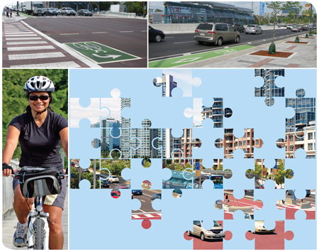
We’ve been focusing recently on all the features of the new rapidways, which together are going to make transit truly rapid along Highway 7.   But it’s important to remember that many of the design features were developed to ensure that all users of the Highway 7 corridor feel welcome and secure.  This includes transit users, pedestrians, cyclists and drivers – the “complete street” design concept which you can read more about here.  One of the features that have been installed on the rapidways are new dedicated bike lanes and bike boxes, which are painted green.

To provide safety and convenience the new bike lanes will extend 5 kilometres, from Chalmers to South Town Centre Boulevard with lanes on both the north and south sides of Highway 7.  Unlike in many urban settings, York Region cyclists will have these lanes to themselves –our new bike lanes are dedicated, meaning they’re not shared at any point with vehicles.

We’re following the established safety standards, making the lanes 1.4 metres wide, with an additional half metre for a buffer zone between the bike and traffic lanes. Also to give maximum visibility for the bike lanes, they’ll be painted a high-contrast green in the areas around intersections, with special bike-lane markings to clearly identify them in the mid-block.

With the high volume of traffic, the bike lanes will provide a much more comfortable and secure environment for cyclists riding along Highway 7.  But eventually most cyclists will want to turn off of Highway 7, with some needing to make left turns.  Waiting in the left turn lane with vehicles to cross multiple lanes of traffic and the rapidways wouldn’t be safe on a bike, so we’re adding another feature to make the experience better for cyclists.  They’re called bike boxes, and they will make the corridor more welcoming to cyclists.

Here’s how they work.  Cyclists wanting to turn left off Highway 7 will proceed through the signalized east/west intersection in the bike lane into the far side  then stop in a protected area, reserved for cyclists, tucked into the boulevard on the far side of the intersection.  This area, known as a bike box, will offer cyclists a waiting zone while they wait for the light to change.  Once the light changes, they will then cross Highway 7 along with other north/south traffic.

The bike boxes will be clearly marked with green paint like the bike lanes and other markings, so drivers and pedestrians will know they are for cyclists only.  Permanent bike boxes will be put in place this fall and replace the painted ones on the street, so by next spring cyclist will have a great new pathway to follow, with the latest of features.

We’re excited to be providing these new features for York Region cyclists, and know that they’re going to help make this corridor much more welcoming to all travellers, no matter how they choose to get around.


Categories
Live-work-play Rapidways Urban Planning

using colour and shape to create welcoming pedestrian spaces

If you’ve walked along the new rapidway on Highway 7, you’ll have seen the vivaNext pavers we’ve installed on the boulevards.  We know from the feedback we’ve gotten that people love the new look.

Most sidewalks in York Region, like pretty much everywhere else, are made of concrete, and the most important consideration is functionality: they need to be safe, accessible, durable and easy to maintain.  But beyond those goals, we also want our new boulevards – which are wider than the Region’s regular sidewalks – to reinforce the complete street concept, the guiding philosophy for our vivaNext streetscape design.  With all the development coming to the Region’s centres and corridors, in the future there will be more pedestrians, whether they live, work, or commute along our rapidway routes.  So we’ve made sure that our boulevard design is going to be visually appealing as well as functional.

The boulevard is made up of the pedestrian zone and the furnishing zone. The pedestrian zone is typically a 2.0m wide sidewalk which is fully paved with light-toned coloured pavers near intersections, and paved with concrete in the mid-block areas. The sidewalk is a continuous system even across driveways to alert motorists that pedestrians have priority.

The furnishing zone is located next to the pedestrian zone. The furnishing zone is an area where pedestrian amenities, furniture and planters are located. It is paved in light coloured unit pavers which reinforce the identity of the vivaNext system.

We’re using a combination of coloured pavers which not only look great but also add to wayfinding for pedestrians.  The main field pavers are light-coloured cool gray with contrasting coloured accent bands which will increase in frequency as pedestrians approach the main intersections. The east-west accent bands are a red; the north-south accent bands are a dark charcoal gray.

Immediately adjacent to the roadway and running along beside the pedestrian zone is a 610mm wide “transition zone”, which will provide an important comfort buffer against bicycle and vehicular traffic. In the winter months, it also provides an area for snow storage and protects the adjacent plantings from salt spray. This zone will be paved in special “eco-pavers”, which allow water to seep through to the storm sewer system.

A charcoal gray coloured textured warning strip will alert visually impaired pedestrians that they are approaching an intersection or driveway. At midblock where the pedestrian zone in paved in concrete, the warning strip will be grooved concrete. Both approaches will provide a tactile clue for visually impaired pedestrians of potential conflicts.

We’ve given special attention to the boulevards near intersections to ensure they reinforce pedestrian priority and add to placemaking. These areas have been designed to function as urban plazas with unit paving and accent pavers. Soft landscaping will define the corners of the intersections and function as gateways to the adjacent areas.

By making the boulevards along the rapidways welcoming and attractive, we’re contributing to the development of York Region’s new urban centres, and adding more walkable places for us all to use.