Categories
Announcements General

Your Community Liaisons are here to help

You might recognize Andrea Witty’s name or face from our website or from construction bulletins that you’ve signed up for. Andrea is working with residents and businesses in Newmarket and Richmond Hill as the rapidway construction projects move ahead.

“It’s exciting to work in communities that are near and dear to me,” says Andrea of her past two years with vivaNext. “I have a unique opportunity to hear directly from people living and working in the community as we watch York Region transform.”

Joining forces with Andrea is Nimisha Raja, our Community Liaison Specialist for Vaughan and Markham. Over the past six months Nimisha has been making contact with businesses and residents along Highway 7 as preparation for rapidway construction progresses.

“I’m thrilled to see a tangible part of the rapidway projects being built in Markham,” said Nimisha of the new vivastation located at Warden and Enterprise Drive. “I can picture how the rapidways with these vivastations will change Highway 7 in Markham and Vaughan. What an exciting time!”

Both Andrea and Nimisha are out in the community, making presentations and answering questions about the projects, construction schedules and potential impacts.

We hope that our website, Facebook page, or construction bulletins will help you find answers to your questions. But if you would rather speak to someone, or you’re wondering about your specific property, Andrea and Nimisha are available and happy to talk to you.

Newmarket and Richmond Hill:

Andrea Witty
Community Liaison Specialist
Telephone: 905-886-6767 Ext. 1022
1-877-464-9675
Cell phone: 416-554-1890
Email: andrea.witty@york.ca

Markham and Vaughan:

Nimisha Raja
Community Liaison Specialist
Telephone: 905-886-6767 Ext. 1023
1-877-464-9675
Cell phone: 416-712-8938
Email: nimisha.raja@york.ca

Categories
Community Events

Who has wheels and big blue antlers?

We do! Look for us this Sunday in the first two of five Santa Claus parades! We’re helping Santa say hello to the crowds along his route.

Happy Holidays enroute, from vivaNextWe’re saying happy holidays and also saying thank you to our residents as we begin rapidway construction along our Davis Drive and Highway 7 corridors.

We’ll be sending you our season’s greetings using modern transportation, and we’ll be suited appropriately for leading Santa’s sleigh – in vivaNext style of course!

Planning these parades has put us in a festive mood, and we hope you’ll give us a wave while you wait for Santa Claus to come to town.

Parade Schedule:
November 14 – Vaughan – starts at 2pm
click here for a parade route map
November 14 – Richmond Hill – starts at 1:30pm
click here for a parade route map
November 20 – Newmarket – starts at 11am
click here for a parade route map
November 27 – Markham – starts at 11am
click here for a parade route map
November 27 – Aurora – starts at 6pm
click here for a route map

Categories
Urban Planning

Coming to your region soon: getting around the GTHA without a car

Viva Rider

Some of us can still remember when a drive across the Greater Toronto and Hamilton Area (GTHA) took you through a mixture of urban and rural scenery. Hard to believe now, isn’t it? Much of our region is now one interconnected, pretty much seamless urban expanse, from Hamilton all the way to Oshawa and beyond. And people’s travel patterns reflect this regional reality; many residents travel all over the GTHA for work, entertainment, shopping and recreation. We are truly citizens of a great region, not just of one town or city.

Unfortunately, getting around the GTHA by transit is anything but seamless. With nine separate transit services operated by various local and regional municipalities, connecting from service to service might require multiple transfers and waits at each municipal boundary. For some commuters, the hassle of transferring might make it easier to drive, even with all the congestion on our roads. Given all the environmental reasons for reducing car trips, that’s really a shame – but until there’s a better option, we know lots of people will stick to their cars.

The good news is that a more coordinated rapid transit network is on its way, and our vivaNext plan is going to play a large part.

Looking at the map created by Metrolinx you can see how the future system will be a truly regional transit network. With multiple connection points linking various new services, this new network is going to make it easier and faster for commuters to take rapid transit – whether that means a subway, bus rapid transit, or light rail transit – from one end of the GTHA to the other.

And Metrolinx is currently evaluating a whole range of other rapid transit options, including extending the Yonge Subway up to the Richmond Hill Centre. So as these other projects are funded, the regional network will become even bigger and better.

At the same time as the physical connections are being increased, Metrolinx has also been implementing their new Presto card, which allows you to use one fare card on most GTHA transit systems.

We’re really excited about being part of this huge plan to extend continuous rapid transit all across the GTHA. We know that once this network is built, leaving your car at home and taking rapid transit will finally be a convenient, comfortable and fast option, no matter where you want to go.

Categories
Rapidways Stations Urban Planning

Designing a rapidway

Designing a rapidway

Earlier this year, I wrote a series of blogs about planning for growth, discussing York Region’s long envisioned goal of a true rapid transit system. The system would have to connect regional centres and move the expanding population around quickly, without increasing car traffic. The plans for this rapid transit system have been in the works for several years, and given our population, we know that bus rapid transit (BRT) offers the right technology at this time.

But how did we get from knowing we wanted to have a BRT system, to the actual design of the rapidways?

The first design considerations went back to our basic goals for a rapid transit system: to move a lot of people around efficiently, and to not add to gridlock on the roads (in fact, to reduce gridlock). The easiest and fastest way to create rapidways on existing roads would have been to convert the curb lanes, replacing two lanes of traffic. While this option would have met our first goal of moving people around quickly, it would have also decreased existing road capacity – which would defeat our second goal of not adding to gridlock. This meant that we would have to add lanes to include the rapidways.

Once we knew that, the next design consideration was where to put those new rapidway lanes. Again, we referred back to our first goal: to move a lot of people around quickly. The basic benefit of rapid transit is that it provides a consistent, reliable way of getting from point A to point B. Riders know how often the vehicle will arrive, how long the trip will take, and they know they can count on it, no matter how heavy the traffic. So what are the design considerations to ensure a consistent, reliable ride?

One key design requirement is to provide level boarding, meaning that passengers don’t have to climb up or down steps onto the vehicle; for example, subways have level boarding. With level (or close to level) boarding, people have better access, regardless of their level of mobility or whether they are pushing a baby carriage. Level boarding allows more people to get on and off quickly and results in shorter dwell time, which means vehicles spend less time at stations. In short – level boarding helps make the service faster, which in turn helps vehicles keep to a schedule, and provide a consistently reliable, frequent service. These improvements make transit more appealing to more people – which meets our first goal.

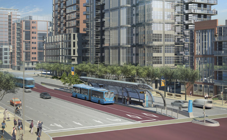
But to provide level boarding, the platforms have to be close to bus floor height – which is about a foot off the ground (most sidewalks are closer to 6″ high). To provide higher platforms, our stations needed to be separated from sidewalks. Theoretically, we could have built higher platforms on the edges of sidewalks, but there are reasons why this isn’t ideal: our stations would take up too much of the sidewalk, which could interfere with local businesses. Therefore, the best place for our stations would be to have them physically separated from the sidewalk. In our case, this meant locating stations in the middle of the road. The benefit of having the stations in the median, is that passengers won’t have to walk all the way across the road to get to a station – they can meet us half-way.

But by adding the rapidways down the middle of the road, we then needed to widen the roads to accommodate both the rapidways as well as the existing traffic lanes. All of which takes us to our final design, which is have our rapidways running along the median, with median stations, and special left turn and u-turn lanes at intersections to allow drivers to safely and easily turn across the rapidways.

Of course, going this route has required more steps, including acquiring the land needed to widen the roads. But the end result is going to be a rapid transit system that meets our goals of providing fast, consistent transit, without adding to existing traffic congestion. And that’s a design solution that we can all be really proud of.

Categories
Rapidways Stations

first new vivastation is coming together!

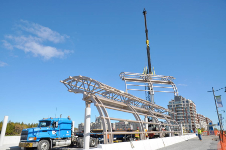
Metal framework being raised into place at one of our new vivastation platforms

The first vivastation designed for our new system of rapidways is becoming a reality. The arched metal framework for our new vivastation platforms at the intersection of Warden Avenue and Enterprise Drive has now been raised into place, and glass canopies will be added over the next few weeks.

This vivastation will be put into service next year, replacing the current Viva shelters at this location. Passengers using Warden Station can look forward to a new level of comfort next winter, with an enclosed, heated, and LED-lit section and an arched glass roof to shelter them as they get on and off our vehicles.

The new vivastation is located at the western gateway to Markham Centre, where a vibrant mix of activities will be available on the streets and squares where people live, work, shop and play. The first phases of residential construction are already underway.

I look forward to seeing the new station in service, and if you use this station, I hope you’ll let us know what you think.

Categories
Community Events

Join vivaNext at the Markham Fall Home Show and get the latest construction info

Markham Home Show
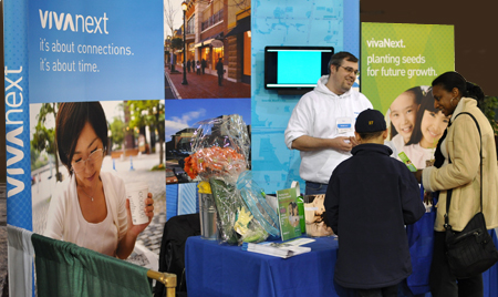
A pair of interested visitors stop by the vivaNext booth at the Markham Spring Home Show earlier this year.

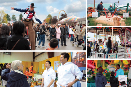
The crisp weather and falling leaves may bring thoughts of cozy evenings and harvest bounty to your mind, but at vivaNext HQ, all we can think about is construction! While you’re at the Markham Fall Home Show looking at ways to make your home snug for the new season, drop by the vivaNext booth to hear about the construction we’re gearing up for. We especially want to tell you about the progress we’re making with the Markham rapidways at Enterprise Drive and along Highway 7. Our team is looking forward to answering your questions about this multi-year construction project, and they can also help you sign up to receive construction bulletins.

Over a hundred vendors will be at the show and you’ll be able to sample their new products and compare services. Gardening experts Mark Cullen and Frank Ferragine will also be there as celebrity speakers. This is Canada’s first zero-waste home show, and to pitch in with that theme we’ll be giving away recyclable tote bags to help you carry all your free samples.

We hope to see you there – don’t ‘leaf’ us hanging!

Markham Fall Homeshow 2010

When: October 15 – 17, 2010
Friday, October 15  (1pm to 9pm)
Saturday, October 16  (10am to 6pm)
Sunday, October 17  (11am  to 5pm)

Where: Markham Fairgrounds
10801 McCowan Road, Markham, ON

Categories
General Rapidways

Transit priority measures to get you there faster

Transit Priority Measures to Get You There Faster

I often talk about the big picture benefits of the vivaNext plan; our rapid transit system will help York Region manage growth through new transit-oriented development; reduced reliance on cars will benefit the environment; greater choice will improve the quality of life for York Region residents. And of course, the main benefit of the vivaNext plan— rapidways will allow people to get around York Region faster than before.

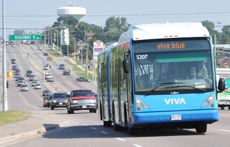
The vivaNext rapidways are going to make a major difference to the timeliness and efficiency of Viva service, but what you may not know is, we took steps prior to Viva’s launch to make the service as fast as was possible. We put various measures into place – collectively called “transit priority measures” – to make it easier for Viva vehicles to get through gridlock. This means that commuters on Viva are already able to cut through traffic congestion faster than people travelling in cars.

Ok, I know what you’re thinking: “There’s no way a bus can go faster than a car unless it’s in its own lane.” Allow me to explain.

In general, transit priority measures are strategies that help buses move quickly along their routes. These measures can involve physical improvements to the roadway, with the most obvious example being dedicated lanes through congested areas (like the vivaNext rapidways!). A less dramatic, but still effective approach is that of queue-jumping lanes, which allow buses to move ahead of congested traffic at intersections. We installed queue-jumping lanes for Viva’s first phase.

Another transit priority measure involves legislative steps. Have you ever noticed the big “Yield to Bus” sign on the back of buses? This transit priority measure was added to Ontario’s Highway Traffic Act to improve transit flow and make transit service more reliable and efficient. This law actually requires drivers to yield the right-of-way to buses trying to leave bus bays and merge with traffic.

The other key category of transit priority measures involves something called “intelligent transportation systems” which are signal system technologies used to improve transit efficiency. Signal systems are quite complex, but in general, modern signals analyze inputs (e.g. vehicles approaching a signal or crossing buttons being pushed by pedestrians) and decide when the traffic lights should change. Transit priority systems add another important input. A bus will automatically send a message to the traffic signal telling it to change, and the signal will adjust its timing in response, favouring the bus. This is not to say that the bus is guaranteed a green light (such as the case of an emergency vehicle), but rather that the delay to the transit vehicle is slightly reduced compared to normal operation (without the transit signal priority).

Viva vehicles don’t “ask” for priority at every signal; priority is only requested when the Viva vehicle is running behind schedule. Currently, Viva vehicles can ask for a low level of priority when they are one minute off schedule, and more immediate priority when they are three minutes behind schedule. And to provide some context, with light cycles in the Region often lasting about two minutes, missing one light can easily put a bus behind schedule. So signal priority is an important tool that helps keep the system running on time, even during the busiest times of the day.

By combining dedicated transit lanes through the most congested parts of Highway 7, Yonge Street and Davis Drive with other transit priority measures in less crowded stretches, Viva is going to offer you a ride that will be comfortable, convenient, fun—and faster than ever before.

Categories
Community Events

The vivaNext Team welcomes the fall season!

Markham Fair

It’s that time of year again! The Markham Fair starts this Thursday and the vivaNext team will be there!

There has been a great deal of progress made on vivaNext projects since last year’s Fair – that’s why we encourage you to drop by our indoor booth for an update! We’re particularly excited about the progress of the Enterprise rapidway in Markham, which is due for completion by the end of this year. We’re also gearing up for more work on the Highway 7 rapidways. With plenty of information and great news to share, the vivaNext team is looking forward to answering your questions about rapid transit in Markham and York Region.

We hope that you enjoy the wide selection of food, live entertainment, activities and competitions the Markham Fair has to offer. This annual event is one of the oldest country fairs in Canada, and is a great way to spend time with family and friends, connect with the community, and welcome the fall season!

See you there!

For a coupon offering $2.00 off adult admission to the Markham Fair, please click here.

Markham Fair

When: September 29 – October 3, 2010
Thursday – Saturday: 9am – 10pm
Sunday: 9am – 6pm

Where: Markham Fairgrounds
10801 McCowan Road, Markham, ON

Categories
Rapidways

Connecting the past to the future

Connecting the Past to the Future

One of the best things about my job is that I get an opportunity to work with people who are really passionate about their community, and who want to share their knowledge and enthusiasm with others. One such group that the vivaNext team has had the privilege of working with over the past year or so is Heritage Newmarket, a committee that advises Newmarket Town Council on various issues related to the Town’s history and heritage properties.

An important part of the Heritage Newmarket mandate, and something that we’re proud to support, is increasing public awareness of the history of the Town of Newmarket. We believe that while we’re building the rapidways along Davis Drive, we have a great opportunity to build various features into our design that will tell people they’re in an historical district, and help build local knowledge and appreciation for Newmarket’s heritage.

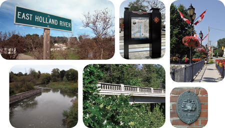
One theme that we will be highlighting is, of course, transportation in its many forms. From prehistoric times, nomadic indigenous peoples roamed the area now known as Newmarket, searching for food and shelter. By the 12th century, the Rouge, Humber and Don Trails, connecting Lake Ontario and Lake Huron via the Holland River and Lake Simcoe, were well established travel routes for these early inhabitants. European fur traders first travelled here 400 years ago, and when York County was established in 1792, a road named Military Street was built to replace the trails that connected Lake Ontario and Lake Huron. This road, which ran from York (now the City of Toronto) to the Pine Fort at Holland Landing, was eventually renamed Yonge Street.

By the mid-19th century, more and more people were coming to this area, including day-trippers to the Saturday Farmer’s Market and the North York Agricultural Fair, as well as business people. The Ontario, Huron & Simcoe Railway built a rail line to more effectively connect Newmarket and Toronto, travelling up Yonge Street and over to the Main Street area in Newmarket. And in the early 20th century, a canal system to transport goods was built in Newmarket. Although it was later abandoned, remnants of the system can still be found today along the Holland River.

So how will we be commemorating this rich history along the Davis Drive rapidways? Detailed planning is still underway, but our concept is to highlight heritage features in two areas: at Davis Drive and Main Street near the historic downtown, and along the Keith Bridge. Our urban design team is exploring ways of incorporating distinctive features such as lighting, pavement treatments, street furniture and other elements with a heritage aesthetic.

We know that there’s a really interesting story to be told, and we will be working with Heritage Newmarket and others to provide more information in these key areas, possibly through plaques, informational signage, and more. In the meantime, if you want to know more about Newmarket’s fascinating history, I’d encourage you to check out the links below to learn more about the Town and see how vivaNext is but the latest chapter in the ongoing story of getting people from A to B.

Links:

Categories
Rapidways Urban Planning

Planning for urban renewal on Davis Drive

Planning for Urban Renewal on Davis Drive

If you’ve driven along Newmarket’s Davis Drive recently, you’ve probably noticed the signs of impending construction work, including building demolitions and soil testing. These preliminary tasks are taking place to prepare the roadway before rapidway construction begins. The actual construction stage is the final step in what will have been a long process of planning for urban renewal and redesign along Davis Drive – a process that will transform this important street in some exciting ways.

Much of the planning for the Davis Drive rapidway is as concerned with urban design as it is with public transit improvements. So what do we mean by urban design and what are the issues on Davis Drive?

In general, urban design is about deliberately shaping neighbourhoods and cities using architecture, landscaping and city planning. It’s about arranging things such as buildings, public spaces, services and amenities, in a way that will provide a certain feel or character.

When we started to design the Davis Drive rapidway, we had a number of urban design objectives. It goes without saying that the rapidway needed to be both functional and attractive. As with all of the rapidways, Davis Drive will use a design sensibility that reminds people of how innovative, exciting and fun Viva is.  Every element we will be using along Davis Drive, from station features to the pavement, retaining walls, handrails, and lighting, will reflect and repeat a consistent, appealing look that speaks to what Viva is all about.

But more than that, in keeping with the principles of transit-oriented-development, we wanted to create new destinations along Davis Drive, making it even more welcoming and friendly for people. The idea is to make Davis Drive feel like an urban space, encouraging people to walk around and visit local shops and restaurants. And with increased visitors, new development is more likely to take place, resulting in even more destinations and potential visitors.

Our plans for Davis Drive include wider boulevards, with pleasantly planted areas, trees, street furniture and landscaping. High-quality pedestrian and street lighting will provide an attractive, welcoming environment at all times of day. These elements will be designed to a human scale, which will make people feel more comfortable walking around and enjoying the sights and activities.

Another design objective has been to forge a strong connection between the heritage flavour of Main Street and Davis Drive itself. Main Street has a lot of character, and we want to extend some of that charm out onto Davis Drive; we want to provide a cue to people as they travel along Davis Drive that they are entering the old-time heart of Newmarket. So around the intersection of Main and Davis, our rapidway design will include some elements to visually connect the rapidways to the heritage area, including the street furniture, lighting design and the bridge over the East Holland River. We hope that people will be intrigued by the change in visual tone, and will want to explore more of the heritage shopping areas along Main Street.

Of course, with construction ahead of us, the final product is a ways off. Even so, we’re really excited about the urban renewal that we are a part of on Davis Drive, and we can’t wait to get underway!