Categories
Going Green Live-work-play Urban Planning

urban parks bring us together

urban parks bring us together

Having at least one feature park is a hallmark of a great city. Central Park in New York, Stanley Park in Vancouver and High Park in Toronto – they’re all natural gathering places. We go there on a hot summer day to find some shade or a splash pad, and on a snow day we go there to skate or make a snowman. Parks make our towns and cities more appealing places to live and work, so it’s important to have them right in the centre of things, where we can get to them easily by taking transit, walking or cycling.

Green parks are beautiful, and a refreshing change from the indoors, but there is also something to be said for the more activity-oriented parks and parkettes. In Markham, Toogood Pond and Milliken Mills are full of picturesque trees and ponds, but the Pride of Canada Carousel in the heart of Downtown Markham also offers a fun diversion from everyday life. If you don’t live right around the corner from these, you can get there on YRT or Viva.

In Newmarket, Fairy Lake Park and the Mabel Davis Conservation Area provide green places to gather for sports and culture, connected by the Tom Taylor and Nokiidaa Trails and meeting in the middle at the Riverwalk Commons, where people gather for concerts and events throughout the year. Mabel Davis and the Tom Taylor Trail can be reached via the new Viva yellow route on Davis Drive, and on the south end of town, YRT will get you there.

In Richmond Hill, Lake Wilcox Park has cultural and culinary events most summer weekends, and is a stone’s throw from the new Oak Ridges Community Centre and Pool. A short walk west from the Viva blue route on Yonge Street is Mill Pond Park – the heart of Richmond Hill’s downtown and host to concerts and neighbourhood festivals all year.

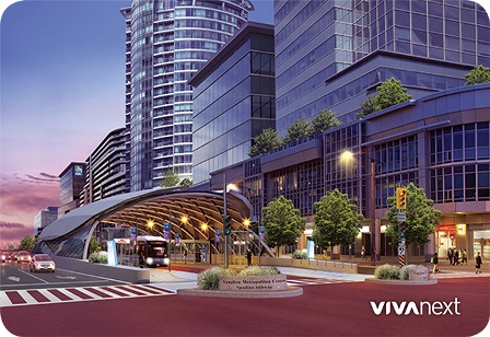
Parks can be activity-focused too, such as Vaughan Grove Sports Park in Woodbridge, offering several soccer and baseball fields just south of Viva and YRT routes on Highway 7. On the northeast corner of Highway 7 and Jane Street, Vaughan Metropolitan Centre will be adding one more important development to this already bustling construction area: an urban park. Edgeley Pond and Park will be in the middle of commercial and residential developments – a place welcoming to all who will live and work there. With a rapidway on Highway 7, the northernmost station of the Spadina subway line and a bus terminal at Highway 7 west of Jane, this park will be connected in all directions.

As we start to see a hint of the spring weather to come, let’s remember how important it is to have great parks, connected by great transit.

 

Categories
economic & financial Urban Planning

change that works

change that works

Cities around the world are searching for safe, sustainable ways to provide mobility to residents across towns and cities. VivaNext, a leader in rapid transit, has risen to the challenge. We pride ourselves on designing a great transportation system that has social significance and measurable benefits.

VivaNext is proud to support the triple bottom line. This business principle holds that business activities should result in financial, social and environmental benefits. The benefits of rapidways are easy to see. For example, the dedicated bus lanes not only allow for fast, convenient service across the region, but they also help facilitate a safer road for drivers, pedestrians and cyclists alike. In addition, emergency service vehicles are able to access the rapidways and cross the median at designated intervals, which improves their response time and bypasses congestion.

What may not be immediately visible, however, are some of the positive economic and environmental impacts rapidways create for communities.

economic development & impact

  • Well thought-out and well-designed transit attracts sustainable, mixed-use development, including new businesses, jobs and a variety of housing options
  • Easy access to transit creates a more desirable mixed-use neighbourhood, and allows for money to be reinvested into the community (through businesses or reinvesting in local infrastructure)
  • Based on other rapid transit projects across North America, property values increase for land within walking distance to transit stations
  • As the Region’s urban transit corridors evolve and attract new retail and restaurants, other new employers wanting to be near transit will follow, continuing to support future economic and social growth

environmental responsibility

  • Every busload replaces approximately 70 vehicles on the road, which means a reduced carbon footprint
  • Rapid transit systems create a safer, more accessible and walkable city

With so many positive benefits of rapid transit, it’s no wonder York Region is a leader in transforming our communities by providing safe, convenient rapid transit. Join us and be moved.

Categories
Accessibility Safety Technical Urban Planning

making corners work for everyone

making corners work for everyone

In civil engineering-speak, curb radius refers to the curve of the curb as it goes around a corner; sometimes it’s a wide gentle bend, and sometimes it’s a tight right angle. So here’s a question: when’s the last time you waited at an intersection for the light to change and actually even noticed the curb radius?  If you’re like pretty much everyone else, probably never.

And yet, believe it or not, the curb radius is one of the most important components of streetscaping, and has a profound influence on how drivers and pedestrians use a street.

As you already know, streetscaping refers to all the elements making up the public spaces along our streets. Because a key vivaNext goal is to make everyone feel welcome on our streets, whether they’re walking, biking, waiting to hop on Viva, or driving, we pay a lot of attention to streetscaping considerations. This includes the curb radii for every single intersection and entrance along our rapidways.

The curb radius describes the shape of a corner, such as when two perpendicular streets come together at an intersection, for example. The curb radius is expressed as a number, taken from the radius of the curve connecting the curbs of the two streets. On a wide suburban corner, the curb radius might be as high as 35, whereas on an urban street corner, it might only be 2.

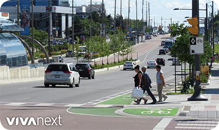
Most urban settings, including along our vivaNext rapidways, aim for a smaller curb radius wherever possible.  That’s because the smaller the curb radius, the shorter the distance a pedestrian has to walk to get to the other side of the road. A smaller curb radius has other impacts too. It results in more space at the corner, including more space for accessible ramps. It makes it easier to line up crosswalks with connecting sidewalks.  It improves the sightlines for pedestrians and makes pedestrians more visible to drivers. And it slows down turning movements for vehicles going around corners, which is safer for pedestrians.

Of course, curb radius design also considers the needs of drivers, including traffic volume, vehicle size, and their desired speed going around corners. It also has to take into account bike lanes, on-street parking, bus stops, emergency vehicles, and other design requirements.  Whether or not the road is part of a truck route may affect the curb radius, because trucks need a larger turning radius to be able to navigate turns while staying within their lane.

Our final curb radius design isn’t up to us alone, of course.  Our designs reflect standards and requirements set by York Region and the municipalities as part of their broader planning for their regional and local road networks. Those requirements in turn reflect the design standards from a variety of authorities including guidelines from the Transportation Association of Canada and the Ontario Ministry of Transportation.

There’s a lot involved in the design of a simple concrete curb than you probably would have guessed. But the final result is for a more welcoming, safe and accessible streetscape for all users.


Categories
Facilities and terminals Stations Transit Urban Planning

connecting people to people

connecting people to people

Have you ever wondered why the central markets, main streets and train stations of old cities thrive for so many years? Whether it’s the Temple Street Market in Hong Kong, the piazzas of Italy, or Toronto’s Union Station, it’s important to have a place to gather and connect. Somewhere to meet a friend or someone new, wait for the next bus or train, or just people-watch.

We all want to be around people, at least some of the time – Aristotle once said “man is by nature a social animal.” So in York Region, we’re hard at work building attractive places to spend our “connecting” time. A warm area at the station while you wait for Viva [it won’t be long!]… a place to buy coffee at the SmartCentres Place Bus Terminal in Vaughan, tree-lined sidewalks in Newmarket for walking along Davis Drive, or a trellis-covered plaza with benches to meet a friend at Cornell Terminal in Markham.

In this world of internet and mobile devices it’s easy to find ourselves isolated from the general population, so we’re using smart design to make sure everything we build connects people – not just vehicles.


Categories
Announcements Facilities and terminals Stations Subways Transit Urban Planning

a connected transit terminal

a connected transit terminal

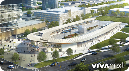
This morning, we marked the beginning of construction for a new YRT bus terminal in Vaughan Metropolitan Centre [VMC]. The news release gives the basic project information, but doesn’t delve into how this terminal will connect in the GTA transit network:

bus

Well, it is a bus terminal. YRT buses will use this terminal, taking customers in and out of York Region’s neighbourhoods and to places farther away like Brampton and northern Toronto. Customers will also be able to walk to the VMC vivastation in the middle of Highway 7, where Viva will take them away on dedicated bus rapid transit lanes. They’ll walk about two minutes above ground, or when the weather is frightful they’ll take the underground path and escalator, elevator and stairs to reach the vivastation.

subway

Customers will take the underground path or walk along landscaped paths outside to the VMC Subway Station entrance just south of the terminal, to access the underground concourse for the Toronto-York Spadina Subway Extension. The subway concourse is actually under the vivastation on Highway 7 – stay tuned for a future blog about this.

walking and cycling

The VMC area is planned as a walkable area with tree-lined sidewalks and places to live, work, shop and take transit. The terminal will meet accessibility standards, and customers will be able to walk or cycle there from any direction.

driving

The terminal is near the intersection of Highway 400 ad Highway 407, so a passenger pick-up and drop off [aka. “kiss ‘n ride”] will be included, encouraging carpooling.


So it’s not your typical bus terminal and it’s more than a place to wait for the bus. It’s about connections, and where they’ll take you from here.


Categories
Urban Planning

building sustainable communities

YouTube video: Building Sustainable Communities

As our towns and cities grow, we need to prepare for the future. Long term planning means that everything we need is all in the right place ahead of time. That means all the major necessities: transportation, utilities, community services and more.

In York Region, we know our population is continuing to grow – by 64% by 2031. Employment is also expected to increase by a whopping 59%, and all this will mean more demands on our roads in general [50% more demand in the morning peak], and especially an increased need for fast, convenient transit.

That’s why rapid transit systems are part of the plans in York Region. Bus Rapid Transit systems are supplying current and future demand with Viva rapidways that offer time savings. On the Highway 7 rapidway in Richmond Hill and Markham, travel times are 42% faster than in mixed traffic.

These improvements to our infrastructure are appreciated. On Davis Drive in Newmarket – the newest rapidway to open – YRT/Viva ridership increased by 39% between February 2016 and February 2015. According to a 2015 survey, 80% of residents living near an opened rapidway believe the project added value to their community.

From Markham to Newmarket to Richmond Hill and Vaughan, it’s about maintaining vibrant, welcoming communities that are prepared for growth and sustainable for many years to come.


Categories
Urban Planning

when urbanism comes to a small city, the impact is big

when urbanism comes to a small city, the impact is big

When urban projects that bring complete streets happen in a big city, they have an impact. A recent big-city example is Simcoe Street in Toronto, which increased pedestrian space and added bike lanes. But to be honest, these projects don’t create the same splash as they do in small cities. In fact, they can get a bit lost in amongst the city as a whole.

When urbanism comes to small or even medium-sized cities, the effect can be huge – even transformative – creating  a new downtown. And the vivaNext and subway project in Vaughan is doing just that.

A recent article, called “New Urbanism’s impact on small-to-midsize cities”, from the American journal Public Square, lays out several remarkable examples of the effects of complete streets’ on smaller centres.

The article describes the positive impacts urban projects have had on a selection of small U.S. cities:

  • Positive impacts in Birmingham, Michigan. Since urbanism came to Birmingham the city now attracts more shoppers and visitors. In fact, in the wake of the urbanism projects, Birmingham has changed its motto to “a walkable community”.
  • Revitalized Albuquerque, New Mexico. Urban changes to land use in Albuquerque have created “a lively mix of entertainment, shopping, office and houses in place of cheap surface parking and underused buildings.”
  • Formerly forlorn Providence, Rhode Island. Before the urbanism project in Providence, the city had a deserted, empty yet heritage-rich downtown. Urbanism has brought the area back to life “with a vengeance”.

Closer to home, the Highway 7 East vivaNext project in Markham has transformed the street from being a highway with gravel shoulders, to being an attractive place to walk, cycle, drive and shop with convenient rapid transit Viva buses along the route. The project has helped set the stage for new development in Markham, such as York University’s new campus.

In Vaughan, people are starting to flock to the new urbanized area known as Vaughan Metropolitan Centre, which is seeing new urban development in Vaughan and includes design elements such as pedestrian-friendly boulevards, wider sidewalks, attractive landscaping, bicycle lanes, upcoming bus rapid transit and the Toronto-York Spadina Subway Extension [TYSSE]. New developments are coming to this new mobility hub, transforming the area.

Urbanism in York Region is part of the exciting movement for smaller cities to grow right, serving the Region’s communities for generations to come.

For more information on the vivaNext projects, be sure to sign up for email updates and follow us on Twitter. Questions or comments? Comment below or email us at contactus@vivanext.com.


Categories
Urban Planning

the last mile is the hardest

the last mile is the hardest

The “last mile” has a reputation. It’s been known as the hardest and the greatest, the final step in getting somewhere, regardless of what that involves [or how far it actually is].

Earlier this month, Ryerson City Building Institute released a video trailer in advance of a Last Mile Meetup event they hosted. The video and meetup invited conversation about the #LastMile, and was the basis for a Toronto Star article. The GTA includes lots of suburban cities and towns. And where there are suburbs, there is that last mile challenge – the beginning and end of a commute to work or school. While most of the commute might be easily done with rapid transit, the last mile usually relies on driving, cycling, walking or taking local transit.

Driving that last mile to a commuter transit station might mean parking in a massive, overcrowded parking lot. Walking or cycling are natural choices as long as there are safe, accessible places to and from the station – this of course depends on weather and the distance travelled. Transit is a good option, but we understand that bus schedules don’t always fit in with the always-in-a-hurry commuter and routes may not get riders close enough to their final destination.

This last leg of the journey can make or break the commute. It’s often the deciding factor on whether the entire commute will be done by car or by transit. Everyone’s trip is unique, and might involve extra stops along the way, like picking up kids from a babysitter or stopping for groceries. So there need to be options, and each option needs to be flexible. To arrive at the right solutions for the last mile, most agree that new ideas need to be piloted, such as the dial-a-ride service in York Region, carpooling, ride-sharing, and safe and secure places for walking and cycling.

It comes down to mobility and quality of life. Mobility is about being able to get to and from where you live easily. Your daily quality of life may depend on how you travel that last leg of the journey – is your last mile the hardest… or the greatest?


Categories
Technical Urban Planning

green light, go light

green light, go light

When it comes to traffic lights, there is a clear favourite: no one likes red, but everyone loves green. And those advanced green arrows are great, except that they never seem to last long enough. Seriously, traffic signals are one of those aspects of commuting that we all have strong feelings about. But what determines when a light changes from red to green, and how long that advanced green should last? Let’s try to shed some light on that…

There’s nothing random about the timing of traffic signal phases, and their design has only one goal: to move traffic and pedestrians as freely and safely as possible along our roadways. As with all aspects of civil and urban design, things are more complicated than they might seem, requiring clear priorities and tradeoffs to balance out everyone’s needs. Here are the basics.

In traffic engineering-speak, a signal phase refers to the operation for all approaches to an intersection [e.g., a red light will show for a side street at the same time as the main road has a green light]. A cycle is the entire combination of phases for an intersection [red, green, amber, advanced green etc.]. A cycle can range from 90 to 160 seconds [meaning if you miss a green light, that’s how long you could wait until the next one], although the timing depends on the intersection and the time of day.

Determining what phases are needed for the cycle, and how long each phase will last, reflects the needs of all users – including transit, pedestrians, cyclists and drivers. Some phases in the cycle length ensure that road users are not in conflict with one another [for example, drivers can’t exit a side street at the same time as drivers are going straight through on the main road]. Also, some users’ needs will be parallel within a phase – e.g., pedestrians, transit and drivers all travelling in the same direction.

Decisions about phases, and how long they last, take into account actual traffic volumes and how traffic patterns change throughout the day. Timing is designed to make the intersection work as efficiently as possible [meaning moving through the largest numbers of users], and minimize delays for all road users [although with many roads at or over capacity during rush hour, signal timing alone can’t solve congestion]. Signal priority is also provided to fire, ambulance and transit, where the signals change to provide priority right-of-way to emergency vehicles and some transit vehicles, without violating the pedestrian timings.

Timing for each phase is based on the minimum timings required by provincial standards. These include minimum timings for pedestrians, motorist and vehicle clearance [amber and red timings] based on several factors, including the width of the intersection, and traffic speed [posted and operating].

Proximity to other infrastructure also has an impact on priorities and the timing of phases. For example, the Ontario Ministry of Transportation may have jurisdictional control over the timing of lights at some intersections, depending on how close the intersection is to a provincial highway off-ramp or railway crossing.

Ultimately, any one cycle has only so many seconds, and no one wants to wait longer than they have to. So the design of traffic signals needs to balance everyone’s needs, while working out the best way to move traffic through an intersection and along a thoroughfare, and minimizing delay for all road users. York Region’s Traffic Signal Operations department continually reviews and assesses the performance of the region’s 848 signalized intersections, and adjusts signal timing to get people moving as freely as possible. Please contact traffic@york.ca if you have any traffic signal concerns.

Whether you’re crossing intersections on foot, bus, bike or car, traffic signals are there to move everyone along safely.


Categories
Going Green Live-work-play Uncategorized Urban Planning

adding shade and beauty to three parks

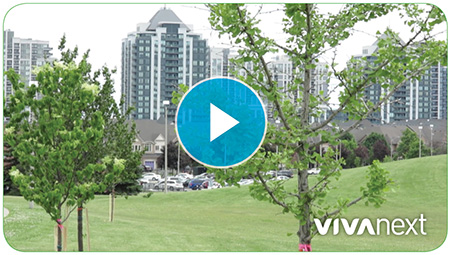
As preparation for road widening got underway this spring along Bathurst and Centre, we were able to transplant 38 trees to three local parks in Vaughan. Watch the video to see how it went!

Here’s a quick background glimpse of the planning: During the final design stage of the rapidway project on Bathurst and Centre, all trees along the corridor were inspected and inventoried, and each tree was included in the construction drawings to see how they were impacted. While some were being removed for road widening preparation, those suitable for replanting were identified. Those removed will be replaced at the end of the construction project with even more planted.

We worked with the local community to identify locations to transplant the trees, and this June, the trees were transplanted in Bathurst District Park, Bathurst Estates Park and Rosedale North Park.  VivaNext is committed to sustainable options and transplanting trees is one of those initiatives.


Questions or comments? Comment below or email us at contactus@vivanext.com. To stay up-to-date on construction, sign up for email updates at vivanext.com/subscribe.