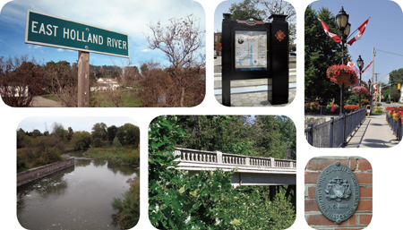
One of the best things about my job is that I get an opportunity to work with people who are really passionate about their community, and who want to share their knowledge and enthusiasm with others. One such group that the vivaNext team has had the privilege of working with over the past year or so is Heritage Newmarket, a committee that advises Newmarket Town Council on various issues related to the Town’s history and heritage properties.
An important part of the Heritage Newmarket mandate, and something that we’re proud to support, is increasing public awareness of the history of the Town of Newmarket. We believe that while we’re building the rapidways along Davis Drive, we have a great opportunity to build various features into our design that will tell people they’re in an historical district, and help build local knowledge and appreciation for Newmarket’s heritage.
One theme that we will be highlighting is, of course, transportation in its many forms. From prehistoric times, nomadic indigenous peoples roamed the area now known as Newmarket, searching for food and shelter. By the 12th century, the Rouge, Humber and Don Trails, connecting Lake Ontario and Lake Huron via the Holland River and Lake Simcoe, were well established travel routes for these early inhabitants. European fur traders first travelled here 400 years ago, and when York County was established in 1792, a road named Military Street was built to replace the trails that connected Lake Ontario and Lake Huron. This road, which ran from York (now the City of Toronto) to the Pine Fort at Holland Landing, was eventually renamed Yonge Street.
By the mid-19th century, more and more people were coming to this area, including day-trippers to the Saturday Farmer’s Market and the North York Agricultural Fair, as well as business people. The Ontario, Huron & Simcoe Railway built a rail line to more effectively connect Newmarket and Toronto, travelling up Yonge Street and over to the Main Street area in Newmarket. And in the early 20th century, a canal system to transport goods was built in Newmarket. Although it was later abandoned, remnants of the system can still be found today along the Holland River.
So how will we be commemorating this rich history along the Davis Drive rapidways? Detailed planning is still underway, but our concept is to highlight heritage features in two areas: at Davis Drive and Main Street near the historic downtown, and along the Keith Bridge. Our urban design team is exploring ways of incorporating distinctive features such as lighting, pavement treatments, street furniture and other elements with a heritage aesthetic.
We know that there’s a really interesting story to be told, and we will be working with Heritage Newmarket and others to provide more information in these key areas, possibly through plaques, informational signage, and more. In the meantime, if you want to know more about Newmarket’s fascinating history, I’d encourage you to check out the links below to learn more about the Town and see how vivaNext is but the latest chapter in the ongoing story of getting people from A to B.
Links:

One reply on “Connecting the past to the future”
you mention the Keith Bridge. is this what the bridge over the Holland river is going to be called?
are there any renderings of what the bridge is going to look like, and is it also going to go over the train tracks also, or just the river?
DaleA: Hi Mike,
Thanks for your question. The bridge along Davis Drive in Newmarket that crosses the Holland River near the Tannery is called the Keith Bridge, and it will cross the Holland River but not the train tracks. I’m sending you a rendering of the bridge as an attachment to an email.
If anyone else is interested in renderings of the Keith Bridge please let me know and I’ll see if we can post them on our website.