unfunded project map
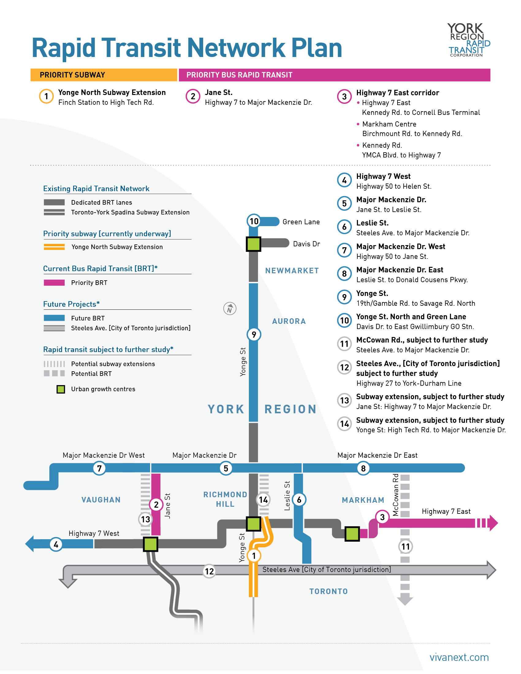
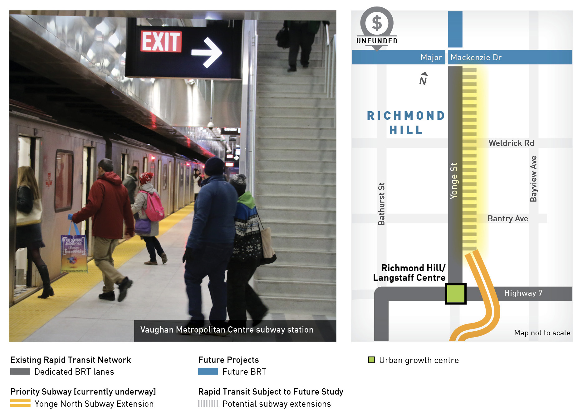
priority subway
1. Yonge North Subway Extension
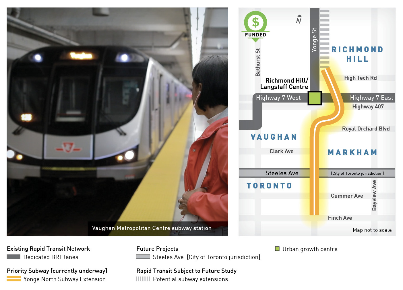
Finch Station in Toronto to Richmond Hill/Langstaff urban growth centre
8 km [5.9km in York Region]
Extending from Finch Station in Toronto to north of Highway 7 in Richmond Hill, reducing travel times to downtown Toronto by up to 22 minutes.
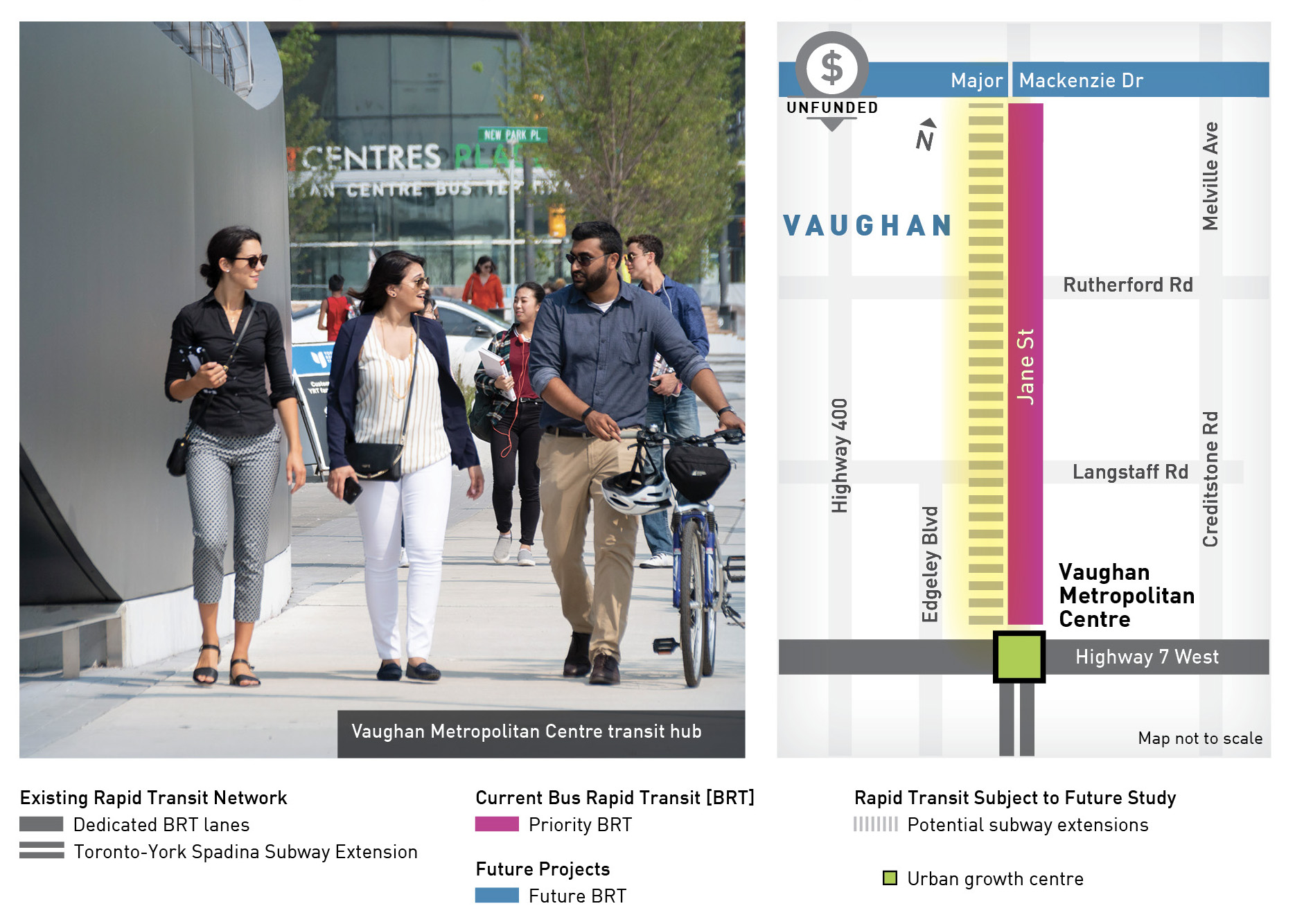
priority bus rapid transit
2. Jane Street
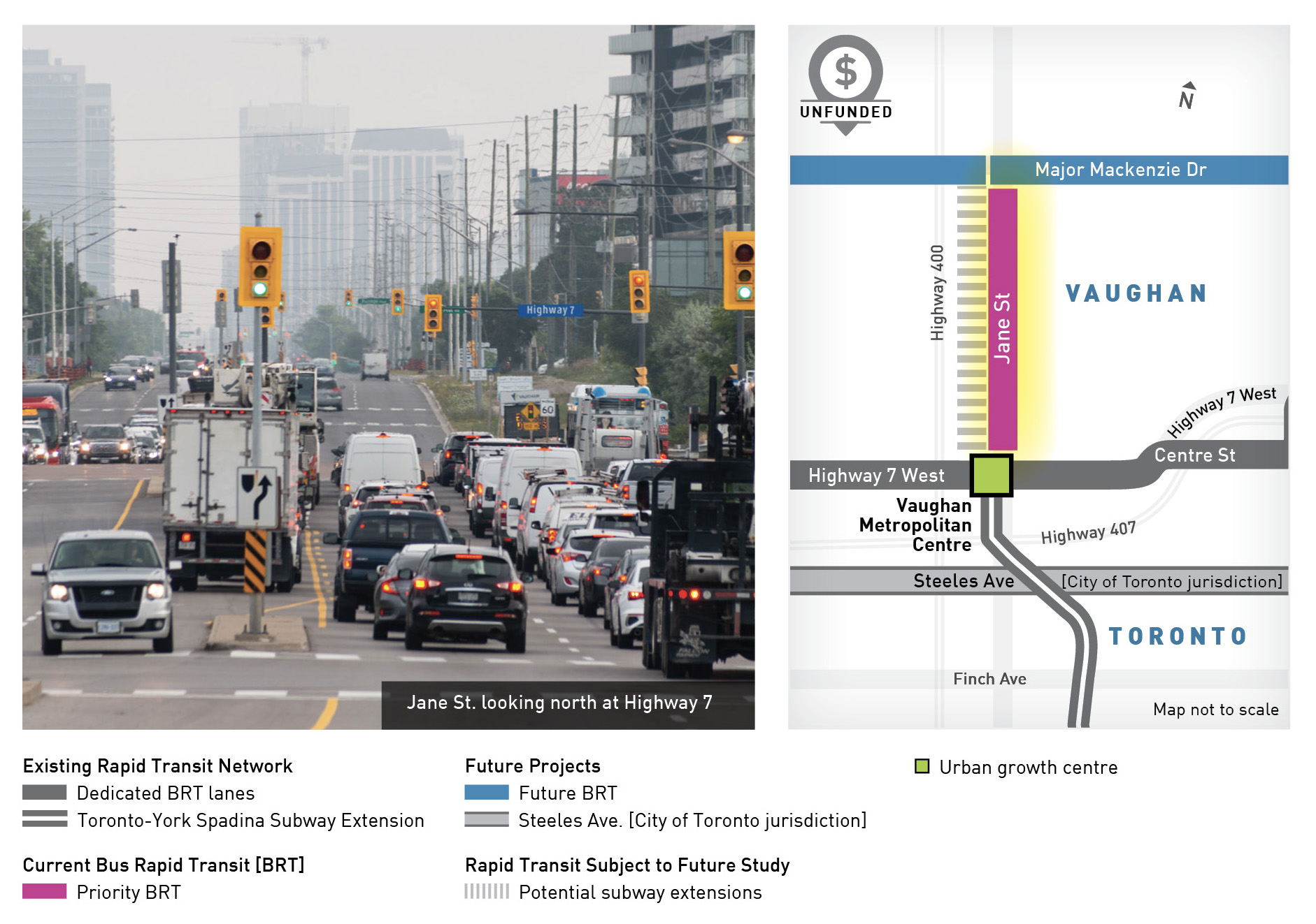
Highway 7 to Major Mackenzie Drive in Vaughan
6.3 km
This important corridor will create seamless connections to Vaughan’s downtown core, subway and bus rapid transit, Cortelluci Vaughan Hospital, Vaughan Mills mall and Canada’s Wonderland.
priority bus rapid transit
3. Highway 7 East corridor
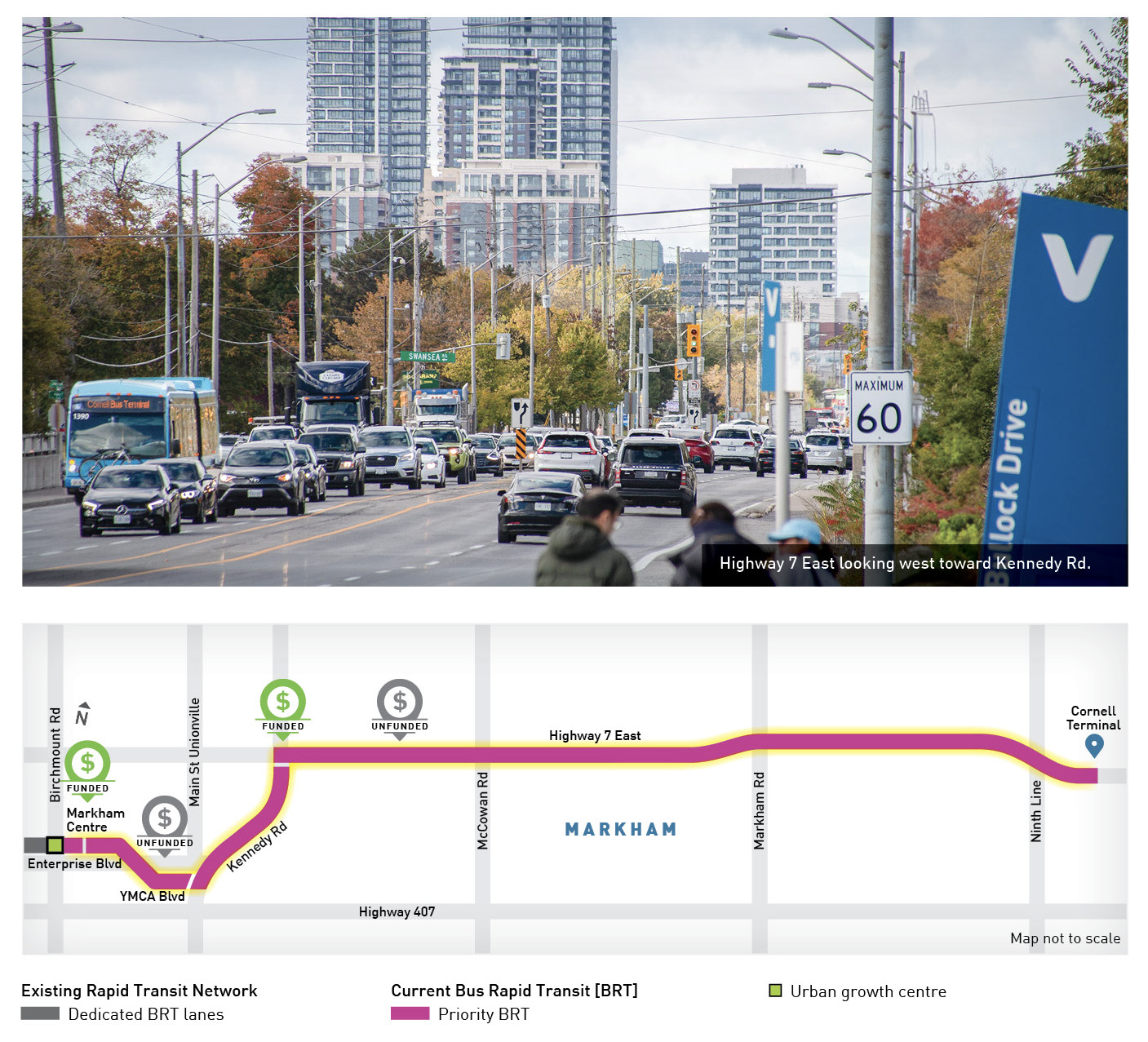
Markham Centre
Birchmount Rd. to Kennedy Rd.
1.3 km
Kennedy Rd.
YMCA Blvd. to Highway 7
1.2 km
Highway 7 East
Kennedy Rd. to Cornell Bus Terminal
11 km
A Bus Rapid Transit extension in the Highway 7 East corridor will support new housing developments and connect to critical services at Markham Stouffville Hospital, servicing daily passenger trips that will increase from 6,700 to over 10,000 by 2035.
phase 2 rapid transit
4. Highway 7 West
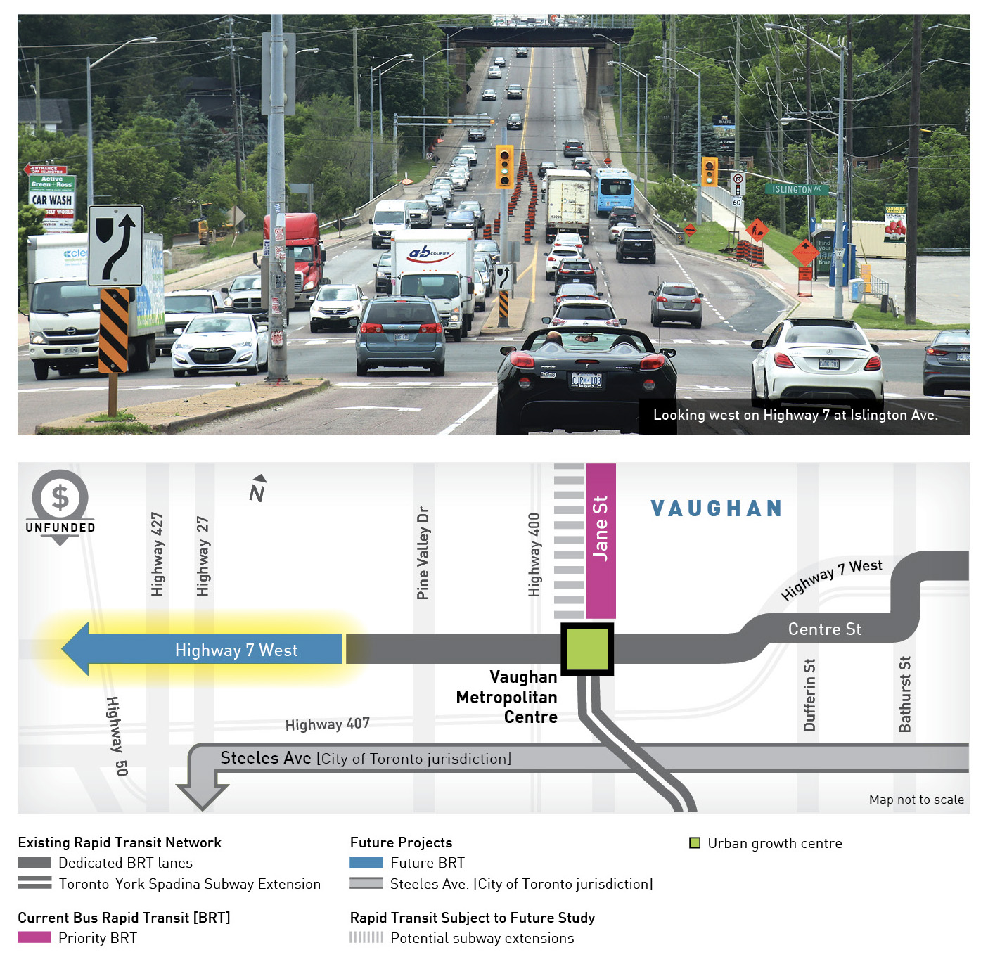
Highway 50 to Helen Street in Vaughan
5.8 km
This segment of Highway 7 West will stop at key destinations in Woodbridge, connecting Vaughan to the municipal border with Brampton at Highway 50.
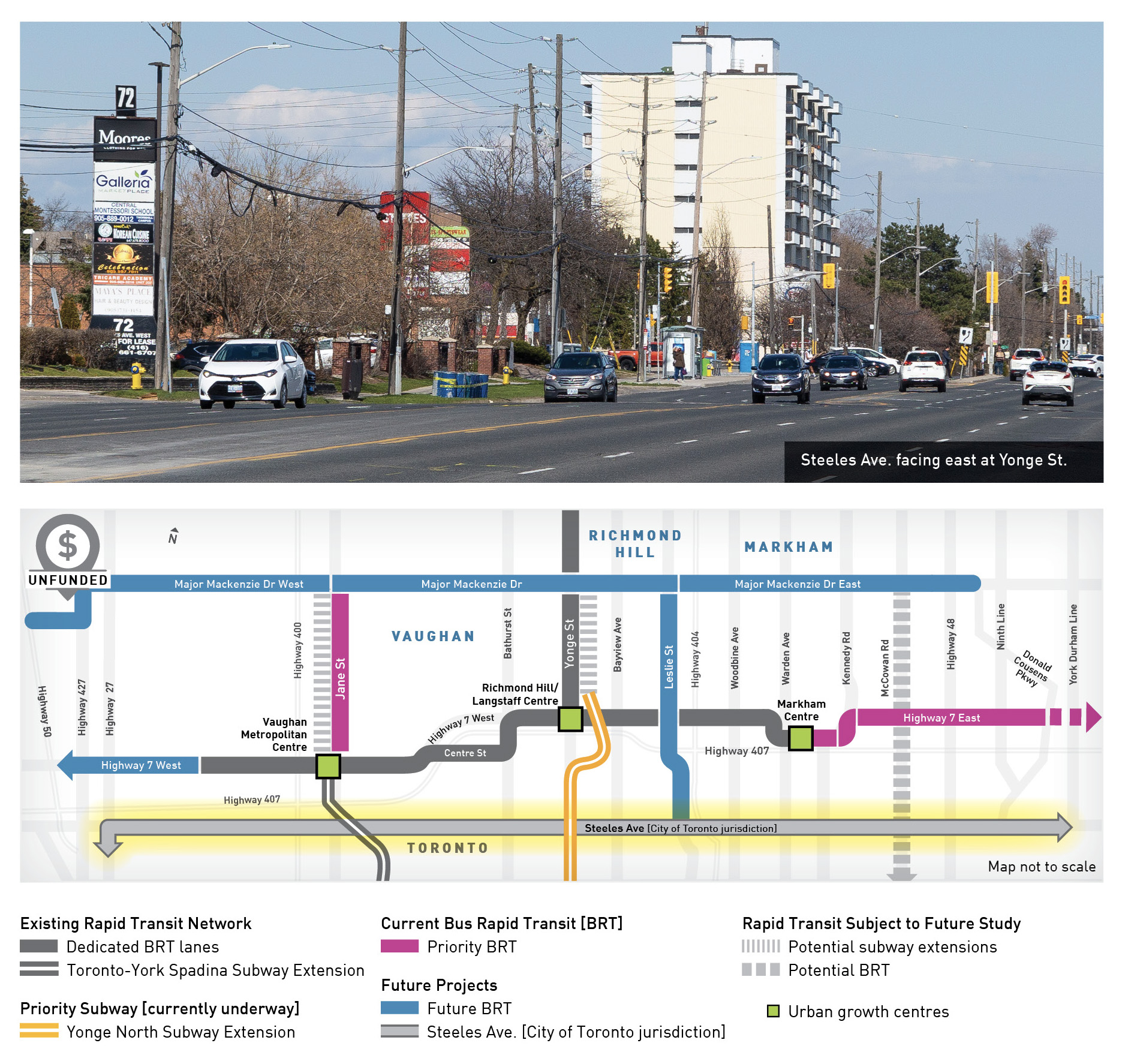
phase 2 rapid transit
5. Major Mackenzie Drive
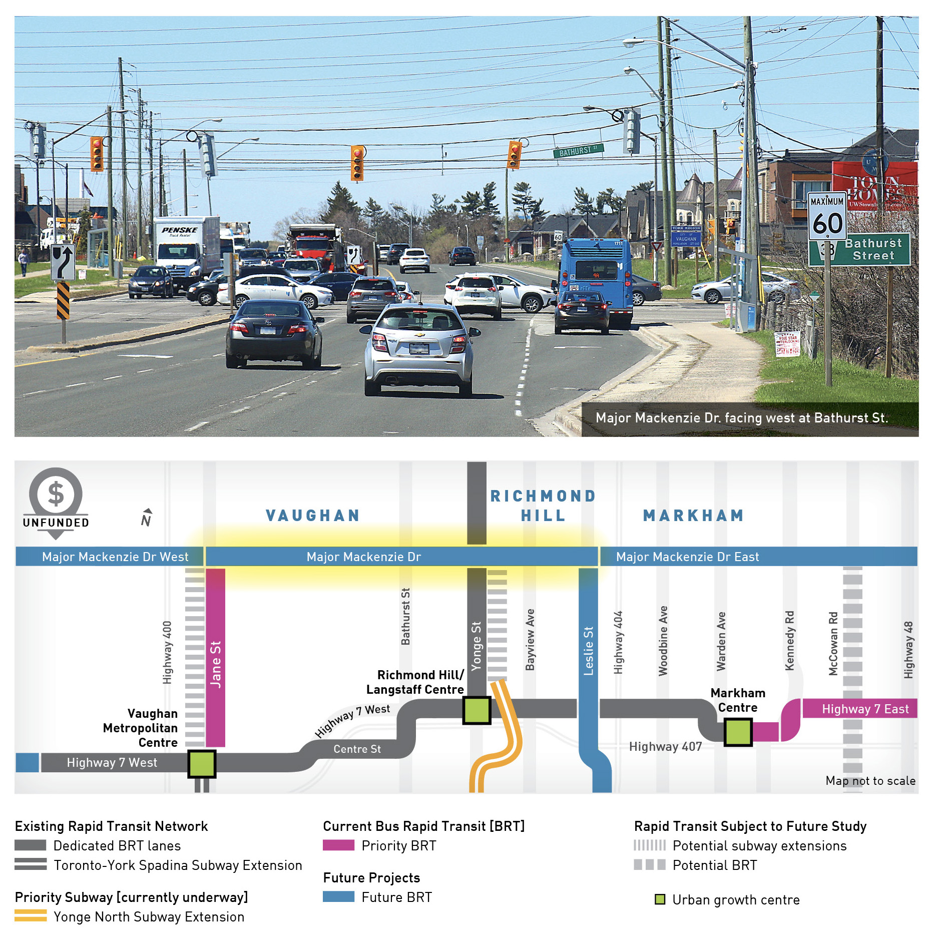
Jane Street in Vaughan to Leslie Street in Richmond Hill
12.2 km
Crossing through Vaughan, Richmond Hill and Markham, Major Mackenzie Drive is a key thoroughfare with destinations including Cortellucci Vaughan Hospital and Canada’s Wonderland at Jane Street, Mackenzie Health Richmond Hill Hospital near Bathurst Street, Richmond Hill GO Train Station of Yonge Street, a future BRT connection at Leslie Street and a carpool lot at Highway 404.
phase 2 rapid transit
6. Leslie Street

Steeles Avenue in Markham to Major Mackenzie Drive in Richmond Hill
8.4 km
One of the key travel routes in the Greater Toronto Area, BRT on Leslie Street will extend from the Steeles Avenue border with Toronto north, stopping near Highway 407 and an entertainment area at Highway 7, and then north in Richmond Hill to Major Mackenzie Drive.
phase 3 rapid transit
7. Major Mackenzie Drive West
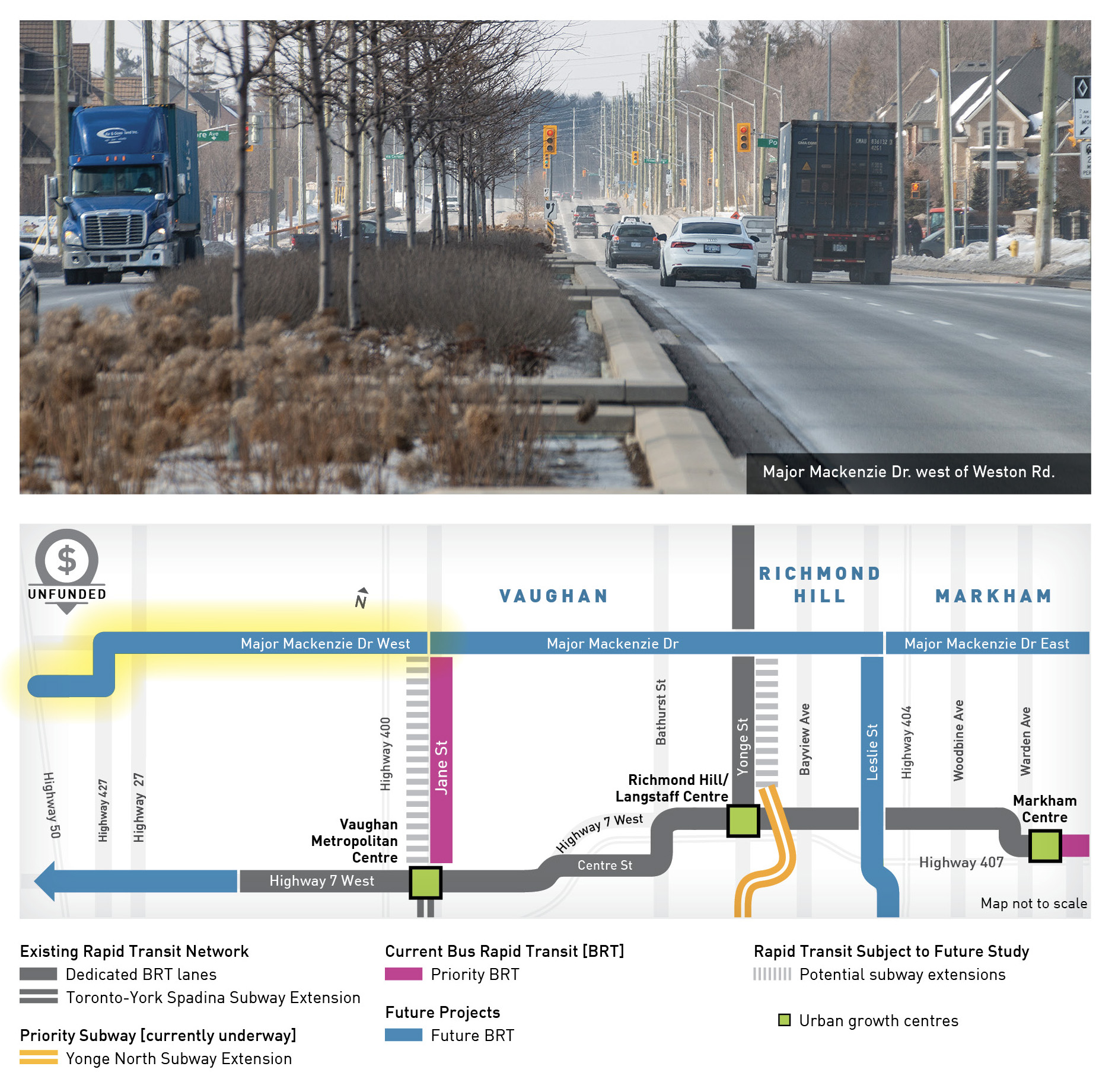
Highway 50 to Jane Street in Vaughan
12.2 km
This segment will connect to the municipal Vaughan/Brampton border at Highway 50, and to the many destinations along Major Mackenzie Drive.
phase 3 rapid transit
8. Major Mackenzie Drive East
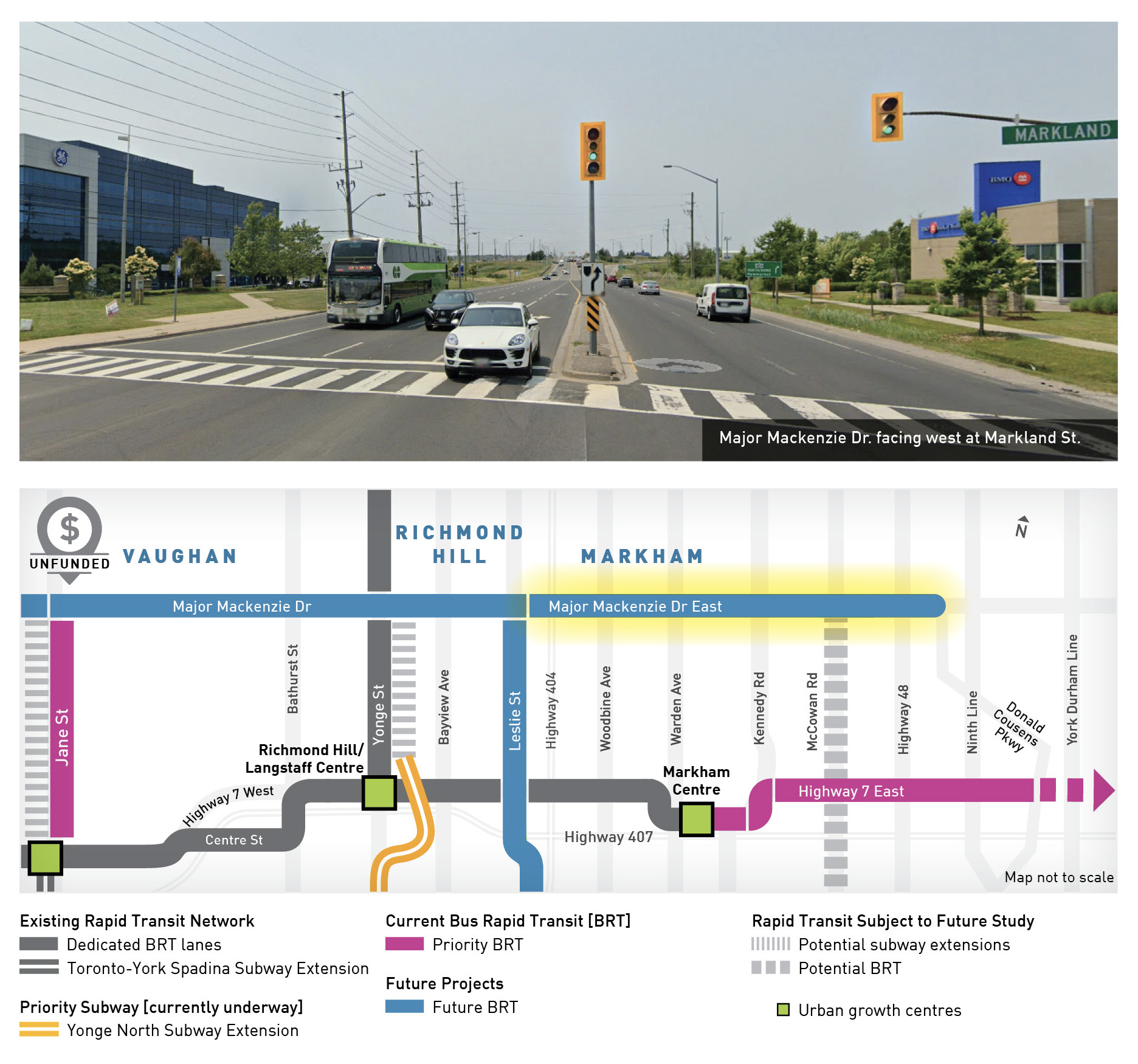
Leslie Street in Richmond Hill to Donald Cousens Parkway in Markham
11.3 km
This eastern segment will cross from Richmond Hill into Markham, stopping at key retail and service destinations along Major Mackenzie Drive.
phase 3 rapid transit
9. Yonge Street
19th/Gamble Road in Richmond Hill to Savage Road North in Newmarket
11.5 km
This key segment of Yonge Street will seamlessly link BRT on Yonge Street in Newmarket with BRT in Richmond Hill.
phase 3 rapid transit
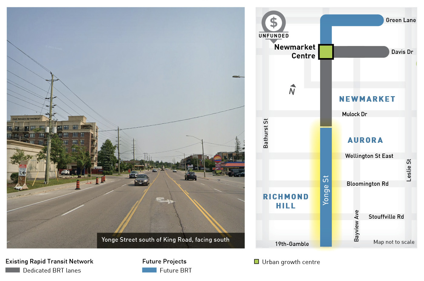
10. Yonge Street North and Green Lane
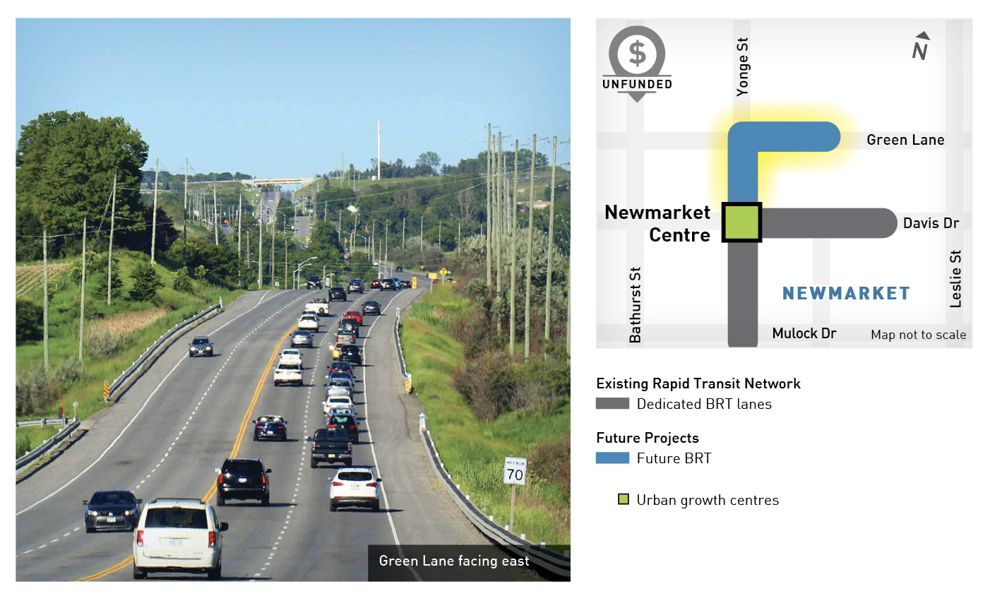
Davis Drive to Green Lane and then east on Green Lane to the East Gwillimbury GO Train Station
4.4 km
On Newmarket’s busiest section of Yonge Street, bus rapid transit will stop at key retail, dining and entertainment destinations, and then curve east along Green Lane to stop at the East Gwillimbury GO train station.
rapid transit subject to further study
11. Potential BRT on McCowan Road
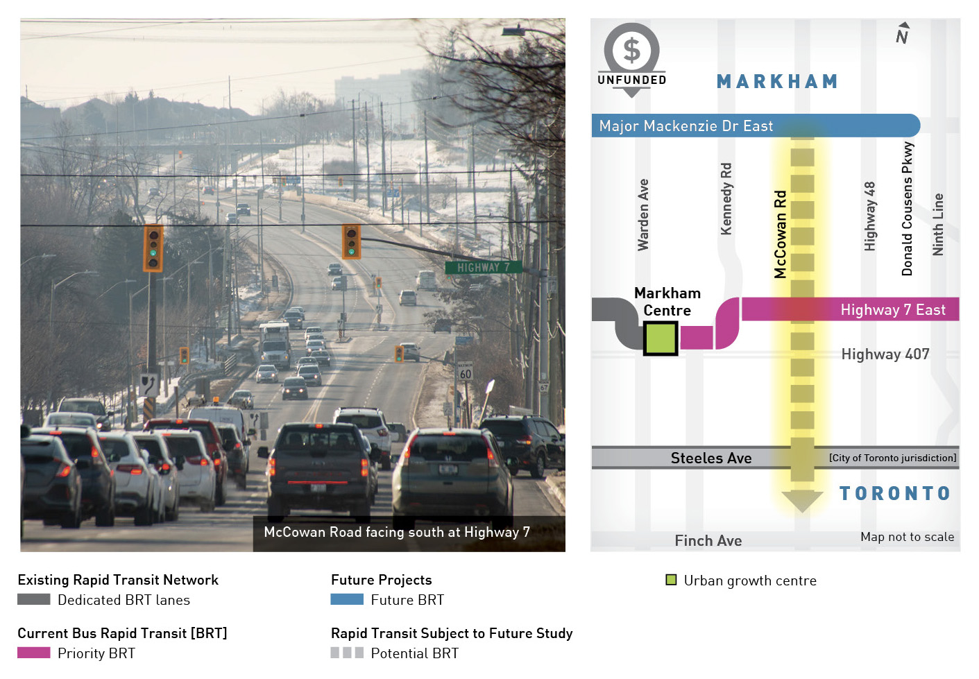
Steeles Avenue to Major Mackenzie Drive in Markham
8.2 km
McCowan Road is a key north-south corridor for residential and employment development, and with further study, in future it may become a BRT project.
rapid transit subject to further study
12. Potential BRT on Steeles Avenue [City of Toronto jurisdiction]
From Highway 27 in the west to York-Durham Line in the east
37.5 km
Steeles Avenue is one of the busiest streets in the Greater Toronto Area, and the boundary between Toronto and York Region.
City of Toronto has jurisdiction over Steeles Ave., and they’ve indicated prioritization from west to east, with the segment from Pioneer Village Station [Jane St.] to Bathurst St. in their highest priority category. Segments east of Bathurst are in second, third, and fourth priority categories, to Bayview Ave., Milliken GO Station, and Morningside Ave. respectively.
Metrolinx’s Regional Transportation Plan has also identified 37 km of future planned rapid and/or priority transit along Steeles Avenue.
rapid transit subject to further study
13. Potential Subway Extension on Jane Street to Major Mackenzie Drive
Jane Street from Highway 7 to Major Mackenzie Drive in Vaughan
6.2 km
York Region’s 2022 Transportation Master Plan identifies that a subway extension may be required farther north in the future on Jane Street, subject to further study.
rapid transit subject to further study
14. Potential Subway Extension on Yonge Street to Major Mackenzie Drive
Yonge Street from High Tech Road to Major Mackenzie Drive in Richmond Hill
4.5 km
York Region’s 2022 Transportation Master Plan identifies that a subway extension may be required farther north in the future on Yonge Street, subject to further study.
*All corridors except the Yonge North Subway Extension and Kennedy Rd. are subject to funding commitments, and are not numbered in order of priority. Network is based on York Region’s Transportation Master Plan. The map is not to scale, and was last revised in August 2024.