Categories
Studies

Study shows you should expect to spend longer commuting

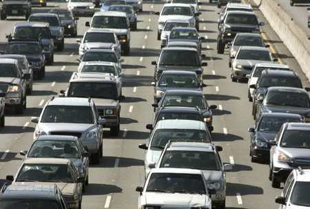
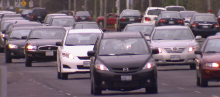
Traffic slowly moving along Highway 7.
Traffic slowly moving along Highway 7 in York Region.

If you think that your commute is taking longer, you’d be right and the bad news is that you’re not alone.

A recent survey conducted jointly by the Ontario Ministry of Transportation, the City of Toronto and the Regions of York, Durham and Peel confirms that average speeds on highways and roads all around the GTA are decreasing. On average, a trip now takes 11% to 21% longer than the exact same trip in 2002.

While this figure applies to the entire GTA, one of the worst long sections of highway is travelled by many York Region residents every day. The section travelling southbound along Hwy. 404 from 16th Ave. to Hwy. 401 during the morning rush hour is the slowest long stretch of highway in the GTA. Motorists see an average speed of 31km/h along this stretch during the morning peak period. Driving along Hwy. 404 during peak hours takes 3.5 times longer than during times when you are able to drive at the posted speed limit.

But York Region roads are not just congested by drivers heading in to and out of Toronto. The study looked at Highway 7 all the way from Durham to Peel Region, an 88 km stretch, and found that three of the five slowest sections were in York Region.

Average speeds on Hwy. 7 through York Region are often almost half of the posted speed limit and not just during rush hours. The study found that driving on Hwy. 7 in the middle of the day is almost as slow as driving it during the morning rush.

The simple solution as we see it is to get more people out of those cars that are causing the increase in congestion and get them on fast, convenient transit.

Do you agree that traffic is getting worse? What are some solutions?

Categories
Subways Surveys

Yonge subway extension backed by most residents

The Ministry of the Environment recently approved the Environmental Project Report for the Yonge subway extension. We recently conducted a survey* to see how many people in York Region support a subway extension to Langstaff/Richmond Hill Centre at Highway 7 and Yonge. Eighty-nine per cent of residents said that they support the extension.

This is very similar to our online poll that shows over 90% of the hundreds of people who have responded thus far support the subway extension. These survey results reaffirm that we are improving rapid transit routes where people need them.

Are you one of these people who support the Yonge subway extension? Or do you think a subway line would be better built elsewhere? Tell us what you think.

*Survey deemed accurate to within 5 percentage points
Categories
Announcements Community Events LRT

Light rail transit coming soon to York Region

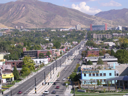
An aerial view of an LRT line in Salt Lake City, Utah showing the transit-only centre lane tracks on which vehicles travel.
An aerial view of a TRAX LRT line in Salt Lake City, Utah with dedicated, transit-only lanes. This is similar to how the Leslie/Don Mills corridor line will be designed.

Imagine a light rail line that could take you from Danforth all the way up the Don Mills/Leslie corridor into Richmond Hill. That was one of the transit projects identified by Metrolinx near the end of last year as part of the master plan for transportation in the Greater Toronto and Hamilton Area.

The light rail line study is now underway and we want your input. We are having a public meeting on Wednesday, June 10, where we will present our plan for the York Region portion of the line that will run on Leslie from Steeles to Highway 7.

The City of Toronto and the Toronto Transit Commission (TTC) are currently undertaking a preliminary planning study to identify an LRT route in this corridor from Danforth to Steeles. Although we are conducting different studies, we are working with staff at the City of Toronto and TTC on the light rail line.

Similar to our vivaNext rapidways, the LRT vehicles will operate in their own right-of-ways – enabling them to safely speed past congested traffic, no matter what time of day.

Like all of our projects, we want to ensure that anyone with an interest in the study has the opportunity to get involved and have their voice heard.

What do you think of a light rail line through this corridor? Join us in person for the meeting or, if you can’t make it, let us know your thoughts by commenting on our blog.

For more information on light rail transit or the current studies please see our website

The meeting will be held:
Wednesday, June 10, 2009
6:30 to 9:00 pm

Hilton Garden Inn
300 Commerce Valley Drive East,
Thornhill, ON

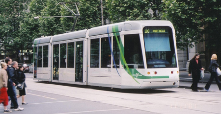
An LRT vehicle traveling throught the streets of Melbourne, Australia.
An LRT vehicle traveling through the streets of Melbourne, Australia.
Categories
Announcements Surveys

York Region residents cite congestion as reason to improve transit

Traffic congestion

We all know that traffic congestion is getting worse. The major arteries, including Yonge St., Davis Dr. and Highway 7, are packed during peak hours of the day and congestion is only expected to get worse. That is a key reason why York Region is taking steps to improve rapid transit and build livable cities.

We wanted to know what you had to say about congestion, so we recently conducted a survey.* When asking York Region residents how they rate traffic congestion on a 10-point scale, over 75% of them said it was between a six and a 10, where 10 was high traffic congestion. In fact, four times more people rate traffic congestion as “high” than rate it as “low”. And almost 25% of the people surveyed rated congestion as an eight on the scale.

When asked about solutions, the largest percentage of respondents said that more and better rapid transit was the answer. People also cited bicycle lanes and more roads as other solutions.

It sounds like we are on the right track to providing those who work and/or live in York Region the solutions they need to avoid congestion.

What do you think about traffic congestion around York Region and what else should be done? Tell us what you think.

*Survey deemed accurate to within 5 percentage points

Categories
Going Green Live-work-play Urban Planning

Save time and relieve stress by getting rid of the commute

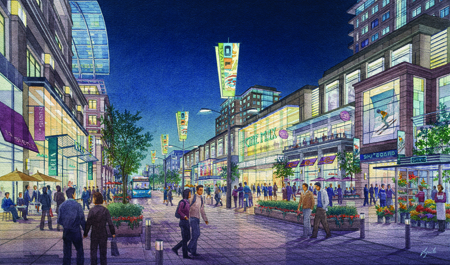
An artist rendering of what the live-work-play community at Markham Centre will look like when complete. Rendering courtesy of the Remington Group.
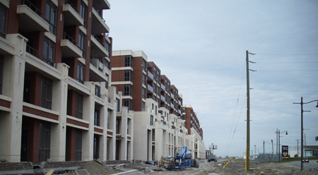
Construction at Enterprise, which will be within walking distance of the above rendering of Markham Centre.

Are you tired of sitting in congested traffic trying to get to work or to visit with friends and family?

I don’t like to think that we are simply designing and building a rapid transit system. We are helping to create live-work-play communities. That’s the basic term for living in a place where everything is nearby. The goal is to create more time in your life and reduce reliance on a vehicle to get around.

Other names for this concept are a mixed-use development or new urbanism. The idea is the same: it is about making communities that let you live within walking distance of work, shopping, restaurants, cinemas, parks and other activities. And when you do have to travel, there are transit options nearby such as subways, rapidways and GO trains.

Unlike many parts of Europe where it’s the norm, it will no doubt require a mind-shift from many Ontarians. But I can tell you that it’s already starting with the youth. They get it from a logical, environmental and social standpoint. I get the sense that they place greater importance on quality of life and that excludes sitting in a vehicle for hours every day.

This shift has also started in our local communities – Markham, Mississauga and Richmond Hill for example.

What examples have you seen? What are your kids saying about it?

Categories
Going Green Rapidways Stations

Gimme Shelter

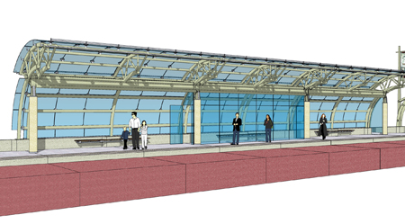
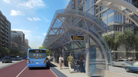
Rendering of a vivastation showing the middle section, which will be enclosed and heated.

As you might have already heard, we are currently working on a video where the lead architect of the new vivastations talks about the design of the shelters for the rapidways we will be building over the next few years.

Since that video is not yet completed and there’s growing interest in how the vivastations will keep people protected from the weather, I wanted to take some time to talk about a few features of the new stations. In a way, here’s a trailer of the video…

There will be three different sections (modules) in each station. The middle section will be completely enclosed and heated, blocking the wind, rain, snow and cold temperatures.

Extensive consultation with the public told us that comfort and keeping warm are very important to riders, which is reflected in the design for the new service.

The stations will be large enough to provide adequate personal space and there’ll be an overhang reaching above the vehicles to protect people boarding and alighting on rainy days.

The stations are also more environmentally friendly. Energy efficient LED lights will brighten the station at night. The enclosed section will have automatic accessible doors at each end of the enclosure. They will still have sensors to open automatically, but as you can see in the picture, the hinged doors are on the side of the enclosed section. This will keep heat from escaping when someone triggers the sensor by walking along the platform. Accessibility has also been top of mind during the design process, ensuring that the platform and station design are accessible for individuals with disabilities.

Each platform will be 55 metres long with a 27-metre glass and steel canopy structure in the middle. This will make the stations easy to find and the curved canopy will blend well into the natural streetscape.

Last week, we had a full day of production, shooting interviews and b-roll for the video. Watch for the finished product on our website in the coming weeks.

Categories
General

Don’t risk it, take transit

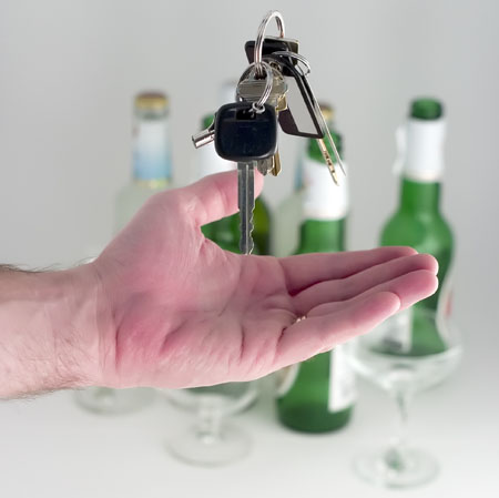
Tough new drinking and driving laws recently went into effect giving people an even greater reason to take public transit.

The tougher penalties mean increasing fines and suspensions for anyone driving under the influence.

Why risk lives when there’s a simple, easy and safe alternative – public transit. Keeping people from driving after they have been drinking alcohol is critical to keeping our roads safe.

As OPP Sgt. Dave Woodford has said many times, most accidents are not accidents, they are collisions and completely preventable.

Hopefully this new law will make people realize that drinking and driving is not worth it – and illegal!

drink_drive_2009_05_12

Categories
Announcements Press Subways

Yonge subway extension closer to reality

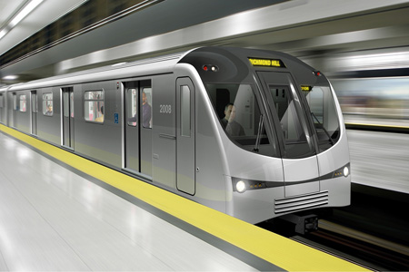
What a subway will look like heading to Richmond Hill station.

We did it. Thanks to your help throughout our extensive public consultation process, we received approval from the Ministry of the Environment for the Yonge subway extension.

This is fantastic news because the extension up Yonge Street will create the backbone for a seamless transit network that will get you to the places you need to go faster and with fewer connections.

The approval from the Ministry means that the project is in a strong position to receive funding and soon after that happens, shovels can hit the ground. The plans are calling for a 6.8 km extension that will include six new stations and finish at the Langstaff/Richmond Hill Centre at Highway 7.

To put together the report, we engaged the public in many ways, including town hall meetings that hundreds of people attended and gave excellent feedback. It was that feedback that allowed us to address many community concerns and in the end, form a solid report.

Our project was the first one to undergo the new six-month process set up by the Ontario government so construction on transit projects could start as soon as possible.

We feel fortunate to have the first project approved under the new streamlined process and we’re excited because this is another step toward making commuting easier for anyone living or travelling in York Region.

Once funding is secured, we will continue to work with you regarding the design details, especially the bridge crossing and parking lot.

Soon this picture will be a reality. It’s time to start imagining a subway with the word “Richmond Hill” on it.

Categories
Live-work-play Rapidways Subways Urban Planning

Transit helps make Centres & Corridors a successful concept

York Region and Toronto planners discuss how to best manage growth over the next few decades.

We recently had the opportunity to co-sponsor the Regional Forum on Centres and Corridors. The consistent message from speakers and the audience was that investment in public transit should be the first priority in making centres and corridors thrive. They also said designing and building town centres linked by fast, convenient public transit helps to shift people out of their cars.

Speakers from York Region and the City of Toronto along with renowned urban planners and architects spoke about managing growth in York Region over the next 20 years. They examined lessons learned from the past to help improve growth management strategies in the future.

To help manage growth, the Region has a plan to focus development around four “downtowns” away from valuable farmland and environmentally important greenbelts. These centres (in Markham, Newmarket, Vaughan, and Richmond Hill) include residential, business and recreational development connected by transit.

The new centres are being developed as live-work-play communities. We will be posting a blog in the near future that talks more about this idea.

To learn more about the Centres, Corridors + Subways program, please visit their website

Read the Official Regional Plan

Read the Transit-Oriented Development Guidelines

Categories
Rapidways

What’s a rapidway and how will it help?

An artist rendering of a viva vehicle riding on the rapidway

Recently, we received $1.4 billion in funding to build rapidways. But what are rapidways? It is the term for centre of the road, rapid transit-only lanes that we will build for Viva vehicles to travel in.

It’s rapid because, without being stuck in traffic, Viva will be able to zip through congested areas making it the better way to get around York Region.

Rapidways will put the rapid into rapid transit. Right now, our vehicles compete with all the other cars and trucks on the road. During times of high volume, the rapid transit vehicles will be able to glide past gridlock and actually make for a faster commute than in a car. It’ll be like driving in the carpool lane, but without even other drivers. Similar to how the carpool lane will save you time, we project that the rapidways will make Viva trips 40% faster.

The system is designed to allow for higher capacity light rail trains to replace buses on the rapidways when ridership warrants it. I will follow-up with a more extensive post about this soon.